Software
Houzz Logo Print
chrholme

Visiting Estes Park, CO...

9 years ago

Hello All!

Tomorrow, Feb. 10th, my hubby and I will be driving from Lubbock, TX to Estes Park, CO and I am wondering if there are any cool nurseries or garden attractions that would be open this time of year anywhere along our drive? Thank you! :)

Comments (22)

  • 9 years ago

    Thanks Skybird! Yes I know this is a long drive- but this will be the first time the hubby and I will be leaving our almost 2.5 year old (it's been almost 4 years since our last getaway together just the two of us!) We are excited, to say the least! I appreciate the suggestions!! It looks like tomorrow will be a great day to be on the road and outside!

  • 9 years ago

    While you're there see how far you can get into Rocky Mountain Natl. Park! Their site says the Bear Lake Road is open, so you should be able to get in a little way at least! And it's conceivable that the road will be open to Rainbow Curve--just a beautiful place to LOOK! (And nothing at all like Texas! ;-) ) If the road is open that far, take some peanuts with you to feed the chipmunks! Not sure if they're out and about in winter, but if they are, it's fun! (The RMNP map says the road is kept open to Many Parks Curve--which is a little way past Rainbow Curve, so maybe you CAN get there!)

    The one thing I'm not sure of is that we're supposed to be getting snow--the mountains--on Saturday, and I'm not sure how far it's gonna be making it over the Divide, so you might need to wait a day or two to do it!

    Have fun,

    Skybird


    chrholme thanked Skybird - z5, Denver, Colorado
  • 9 years ago

    Awesome!! We might head into the park ( we are staying just outside the entrance I believe) first thing Saturday morning to try and beat the snow!! Thanks again!!

  • 9 years ago

    I was checking our (Denver) weather and decided to quick check out Estes Park! It looks to me, assuming you're gonna be there more than one day--which I'm assuming!--that you'd be better off waiting until any time after Saturday to go into RMNP. Our weather changes FAST out here, and by Sunday it looks like it'll be clearing again, and it would be MUCH prettier out there on a sunny day.

    Also, something to keep in mind! Denver, where I'm saying 75º for tomorrow, is only at 5280', but Estes is virtually in the foothills, so the altitude there is closer to 7600'. That makes a big difference temperature-wise! If/when you go into the Park (where you go up in altitude fast) you're gonna need something WARM to wear--it's gonna be COLD, no matter which day you do it!

    Skybird

    Don't know how this will work on "a device!" I use it on a computer--but it's pretty much the best weather site you'll find.

    NOAA/NWS - Estes Park:

    http://forecast.weather.gov/MapClick.php?lon=-105.52458118050767&lat=40.37926463042956#.WJ0HOoWsg-Q


    chrholme thanked Skybird - z5, Denver, Colorado
  • 9 years ago

    I was just out at RMNP a couple weeks ago and I think the only main road that was closed was Fall River Road after Many Parks Curve, so Rainbow Curve is not accessible via car right now. The road to Bear Lake Trail Head was clear and the "loop" thst goes from the Beaver Meadows entrance station, around Horseshoe Park and back out through the Fall River entrance was open, too.

    If you take HWY 7 out of Lyons and go up through Allenspark like Skybird suggested , theres some really good views of Long's Peak which are definately worth it I think.

    Don't know of much gardening stuff along the way this time of year, I think the Denver BG has their orchid show sometime this month, too, but no idea when.

    Enjoy your stay and if you need any other suggestions or info let us know!


  • 9 years ago

    Many Parks is after Rainbow from the Estes side, Zach, so if you got to Many Parks you must have gone by Rainbow Curve. Are we somehow talking "past" each other?

    I did notice something on the DBG site about orchids (pics!), but didn't have time to stop and look for exactly what or when!

    Skybird

  • 9 years ago

    chrholme is probably on the road by now, safe travels and have a wonderful trip! The orchid showcase at DBG is going on now through Feb. 20th.
    Denver Botanic Gardens Orchid Showcase

  • 9 years ago

    Sorry, Skybird, Zach is right: Rainbow Curve is a couple miles beyond (and quite a bit higher) than Many Parks Curve. Once the snow hits, the road closes for the season at Many Parks Curve and, in the immediate aftermath of a storm, may be closed at either Deer Ridge Junction or Hidden Valley.

    Chrholme, the drive up Co 7 from Lyons to EP is definitely more scenic than the more straightforward trip up CO 66/US 36. Well worth it if you've got a clear, sunny day. And if you and your husband are even a little athletic, snowshoeing in RMNP is truly wonderful. (There are several places in town that rent snowshoes.) Plenty of trails at all levels of difficulty and nowhere near the crowds we see in the summertime. You may even be able to catch a ranger-led introductory walk if you're lucky.

  • 9 years ago
    last modified: 9 years ago

    I defer to wiser minds! I checked the map real quick yesterday and just looked again and see that "Rainbow Curve" is right between the REAL Rainbow Curve and the switchback that's just before Many Parks Curve! Looking at it quickly I accidentally saw "the words" next to the wrong curve! Sorry 'bout that! I guess Rainbow is just a Summer Thing! But ANYWHERE, as far as you can get out there, is gonna be beautiful!

    I think of the Park as being pretty much "closed" in winter and never even thought about something like snowshoeing! I'm too olde and have too many damaged body parts to try something like that, but it really would be beautiful to be out there in the snow and QUIET! I second the recommendation if it's something you guys might be at all into!

    Skybird

    While I'm here, here's a link to the map on the RMNP site that I'm looking at. You guys might want to check it out in making your plans--but you can pick up the "real thing" at a Visitor Center.

    https://www.nps.gov/romo/index.htm

  • 9 years ago

    And I snowshoe because I'm too old and have too many damaged body parts to take up skiing! :)

    One interesting thing about snowshoeing in the Park: In many places, rather than following the usual trails (which you can't find), you just walk right up the stream beds. The streams are frozen and buried under enough snow that you'd never even know they were there! In fact, you sometimes come to ridiculously steep sections and realize only later that you've walked up a waterfall. (Anyone who's snowshoed to The Loch will know just what I'm talking about.)

    For those who are less ambitious, the trails around Sprague and Bear Lakes are always good choices and are often (but not always) heavily enough traveled that you don't need snowshoes.

  • 9 years ago

    LOL! It's been a LONG, longlonglong, time since I skied! But I sure do get it how showshoeing would be easier on the body than skiing--especially knees!

    And, WOW! I would LOVE to walk UP a waterfall some day! That sounds very cool--even if you don't know you're doing it at the time!

    You seem to "know" the Park really well, Fred, do you know if Old Fall River Road is open in summer again? In '15, I think it was, I wanted to drive up it, but it was closed because they were doing flood repair work around the Alluvial Fan, so you couldn't go anywhere in that area at all. They said it was closed "indefinitely," and wouldn't give me any idea at all if it was gonna be a year, or two, or more! I just pretty much forgot about it at that point! If you have any info about being able to get to the alluvial fan or going up Old Fall River Road (in summer!) I'd sure be interested.

    Skybird


  • 9 years ago

    My mom grew up in Longmont, so I've vacationed out there all my life. And my wife and I have owned a vacation home now in EP for 15 years. So yeah, I know my way around the Park a bit -- but there's still plenty I haven't seen in the backcountry. (Among other things, I've made seven attempts on Longs, summitting four times. I hope I have at least one more in me.)

    Fall River Road was open again this past summer and, if I remember right, the one before. They had the road open to Endovalley before that, but had bunches of work to do above there before reopening it all the way up. Among other things, they've massively renovated the Chasm Falls viewpoint, adding a big rock and concrete platform with sturdy metal railings. I liked it more rustic, but I suppose it's one of those places visited by lots of first-timers and safety is a priority.

    You may know of it already, but there's a wonderful flower-filled meadow about 2/3 of the way up. At one sharp right-hand turn, there's a gated service road that goes straight off the end of the curve, in the direction of Fall River Pass. If you park there and walk in, there's a ranger's cabin and a gorgeous meadow of a hundred acres or more, filled with flowers and with the river meandering through the middle of it. For me, that's become a real highlight of that drive.

    We had a wet basement from the flood (while we weren't there) but no other major property damage. The water table was so high, though that it came up in a new spring on our uphill neighbor's property, draining down through ours and on into the downhill neighbor's. It was so wet that I trenched across the driveway in two locations to let it drain. It finally dried out after about a year and a half.

    Never again, I hope.

  • 9 years ago
    last modified: 9 years ago

    Thanks for the info! No, actually, I don't know very much of what's in the Park! When I'm out trippin' I do my best to avoid other human beings, and in summer there's no possible way to do that in RMNP! (But I can tell you just about anything you might want to know about the Four Corners area and all the Parks in southern Utah!) I checked the date on my pics, and it WAS in 2014 when the road was closed! TreeBarb and I were up there in fall to see the aspen! The Ranger I talked to made it sound like it would be AT LEAST a couple years, if not three, before Old Fall River was open again, and I had only ever been to the Alluvial Fan once and really wanted to go back, so was really disappointed that time!

    We'll (Barb & I) probably drive up there again sometime, so we'll see if we can find your "wildflower meadow!" Ok, I just pulled up the map (discovered that the link goes to the main page and you need to click on maps to get there!) and I'm trying to figure out where you mean! The only real "right turn" I'm seeing is just past what the map calls "Iceberg Pass," and then goes to a little sharp zigzag that goes to the right, makes a very sharp turn back to the left, and then another sharp turn to the right. Could that be the spot you're talking about? Just past there is something called "Lava Cliffs," which, actually, I don't remember ever noticing! About how far is the walk in? It sounds like a wonderful place to see--and I'm guessin' not very "peopled!" If I/we can find it, it sounds like a good place to check out!

    Wow, it sounds like you got away easy in The Floods! I'm down here in the "high, dry" far north end of Denver, and even I had wet carpet in the basement! You must be at a somewhat higher elevation than the town!

    Yes! Never again! WAY never again! I was out trippin' when "the floods" started, drove back home from Grand Mesa the "second day." It rained the whole way home, but I had been at a cabin that's TOTALLY incommunicado, so I didn't have a CLUE what was happening! By the next morning there was "standing water" all around my house--which is on, basically, level ground, with a slight slope to the street out front. The rain was just coming down too fast for it to drain off! If I hadn't made it back home the day I did I would have been "stuck" somewhere out in the mountains for the duration--possibly sleeping in my car! I didn't know for sure how much rain I got that first day, but the ground was already totally saturated when I got home, and I emptied my rain gauge a couple times the next day when it got to the top! I estimated I got 14" in 48 hours! Never again!

    Skybird

  • 9 years ago

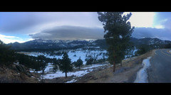
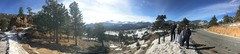
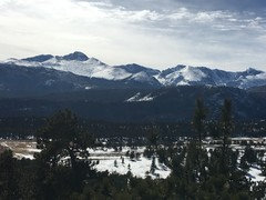
    Well we arrived yesterday just before 2pm (only a 9 hour drive!) and bedsides the 100 mph winds, it was super easy! What I wasn't ready for is how breath taking Estes and RMNP is!! We have decided to make this a yearly get away after only being here 18 hours . Here are some pics from our trip so far. I hope you enjoy them!

    PS: I found a nursery open at the "T" in the road between Boulder and Lyons... great spot and incredibly nice owner!! She had some unique varieties, so if your in the area go check it out!!


  • 9 years ago

    chrholme,

    I'm glad you made it, survived our "wind event" and are having a good time! Looks like you may see some snow today, but we're not expecting much in the Denver metro area. Thanks for the pics and sharing your adventure with us.

    chrholme thanked treebarb Z5 Denver
  • 9 years ago

    OK, the flowery meadow:

    Lest there be any confusion, it's on Fall River Road, not Trail Ridge Road. (There are, of course, lots of beautiful alpine flowers up in the tundra, but that's not what I was describing.)

    Go to Google Maps (maps.google.com) and follow Fall River Road up to the point where it leaves the river and climbs up a series of switchbacks toward the Chapin Creek Trailhead. The very first turn, where the road turns from northwest to southeast, is the spot. If you click into "satellite view", the meadow is readily apparent. And if you zoom in, you'll see one car making the turn and another parked at the corner, plus the service road in to the ranger's cabin. The meadow between the cabin and the river is crisscrossed by a dense network of trails through the willows and flowers. There's a main trail that runs up through the edge of the woods, past a weather station and then I-don't-know-where; we walked a quarter mile or so up there to figure out what the weather station was once.

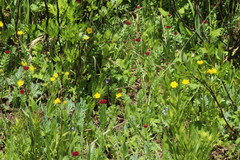
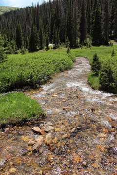
    Here are a couple pix from last July. One, of course, is flowers. (Isn't that the point?) And the other shows Fall River burbling through the meadow. (It's nowhere near as formidable here as down below, you'll see. This is probably within a mile or so of where it starts in that big bowl below the Alpine Visitors' Center.)

    Chrholme, have fun and make sure you give us a report. :) I'll be out there in about a month, myself, and can't wait!


  • 9 years ago

    Lots of pics this morning! Nice!

    Glad you made it safely up here, Texas! You must have been really truckin'! As you've noticed, you are definitely not in Texas anymore! It looks like by tomorrow the weather will be clearing up again, and you'll discover out here that when the sun is out, even if it's COLD outside, it won't feel very cold! "Our" sun, "high altitude" sun, feels MUCH warmer than it does at low altitude places! If you wait till maybe Monday or Tuesday to actually go out into the Park, it's gonna be glorious out there!

    If you don't already have your dance card filled up, you might want to consider taking a walk around the Stanley Hotel! Built in 1909, with a "haunted history," and part of The Shining was filmed there! Here are a couple links--on the first one go all the way down to the bottom of the page for a brief history.

    http://www.stanleyhotel.com/

    http://www.stanleyhotel.com/hauntedhistory

    If you're looking for any more recommendations or advice, just let us know! Somebody will come up with something for you, and, with Fred here as an "Estes Expert," you should be able to get an answer for pretty much anything!

    If you have time every now and then, I know we'd all be interested in how it's going for you!

    Enjoy!

    ~~~~~~~~~~~~~~~~~~~~~~~~~

    Fred--WOW! A place in RMNP--in the middle of summer--sans-people! WOW! I--and if Barb goes too--WE will definitely be looking for that "next time!" WOW! I love both the stream AND the flowers--and then to get them both in the same place! WOW!

    I'd ask if you can hike IN the stream up there--but I already know it's ICE water, so, NOT! For stream-hiking I guess I'll need to stick to southern Utah!

    I was ASSUMING it was on Trail Ridge! Glad you cleared that up! I don't have time right now, but I will definitely check the area out more on google/satellite, and probably on Earth too!

    I, actually, have never been up Fall River Road! Or, well, uh, I was up it ONCE--in 1949! I wasn't quite driving yet back then!!! Ever since then--moved to Denver in '64--it's always been Trail Ridge!

    Another question! In summer are there usually many cars taking the drive up Fall River? I guess I always figured most low-landers would be kinda scared to try it--but, clearly, I could be wrong about that! Is it usually a "line of cars?" From the looks of the meadow/stream I'm guessin' it's not!

    Thanks for all the info!

    Gotta go! Having somebody over for dinner--and haven't done ANYTHING yet!

    Skybird


    chrholme thanked Skybird - z5, Denver, Colorado
  • 9 years ago

    In season, most of the time I'd describe Fall River Road as busy but not really crowded -- until you get to the top. It's not uncommon to find a long line of cars waiting for parking at the AVC. (The road exits inconspicuously behind the store.) I'd definitely recommend doing it mid-week, not on the weekend.

    Funny Fall River Road story: As I mentioned, my mom grew up in Longmont and was there through the period when FRR and Trail Ridge Road were built. When I graduated from high school, three friends and I went out to camp and hike in RMNP (including one of my Longs Peak climbs). We drove out in my dad's car and my parents, because of their familiarity with the area, were sort of the parental leaders (in absentia) of the whole deal.

    Well, my mother hadn't been up FRR in many years and remembered it as pretty hairy. So before we left, she gave us strict instructions: Whatever you do, don't drive up Fall River Road! That place is dangerous! (This, knowing that we were going to climb Longs...)

    Of course, that sealed it -- we simply *had* to drive up FRR! Truth be told, it wasn't all that big a deal. Apart from the fact that I did a lot of the driving with a friend sprawled out on the hood of the car shooting 8mm film!

    It's really quite a tame unpaved road, by Colorado standards, albeit one with some steep dropoffs and great views. I highly recommend it.

  • 9 years ago

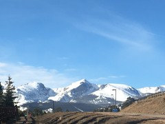
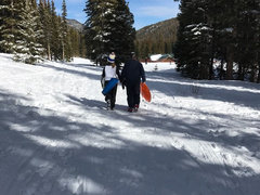
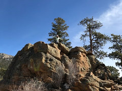
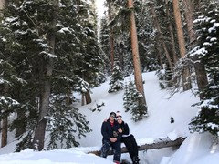
    We have had a wonderful day in RMNP today!! Here are some pictures:

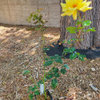
    also, here is a picture of the petunia I purchased Friday from the nursery in Lyons:

  • 9 years ago

    Great pix! Gotta love snow on the mountains! Thanks for sharing.

    chrholme thanked fredbarber
  • 9 years ago

    So glad you're having a good time! Love your pics--and love your petunia too!

    Party on!

    Skybird

    chrholme thanked Skybird - z5, Denver, Colorado