
Search results for "Choices virtually" in Home Design Ideas
 Envision Web
Stuart Wade, Envision Virtual Tours
The town of Blue Ridge offers eclectic shopping and dining in a quaint small town setting. With the historic Blue Ridge Depot at its center, Blue Ridge is a center for arts and galleries, antiques, unique shopping and eateries.
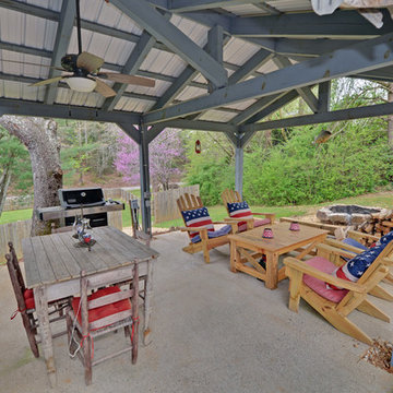
For capturing the best views of your home or cabin, Envision Virtual Tours is your professional and reliable choice for high resolution virtual tours and photos.
Blue Ridge was once considered an elite health resort because of its pure mineral waters. It was established as a railroad town, with the depot at its heart. Visitors would ride the train to town, eat dinner at the Blue Ridge Hotel, and take a leisurely walk to the mineral springs after dinner. Today's visitors still ride the train and take leisurely walks along Main Street, enjoying the antique and specialty shops, galleries, restaurants, small town atmosphere and friendly people of Blue Ridge. The town was founded in 1886 as a result of the arrival of the Marietta and North Georgia Railroad. In the early years, at different times, there were five hotels and several boarding houses in downtown Blue Ridge.
 Envision Web
Stuart Wade, Envision Virtual Tours, Inc.
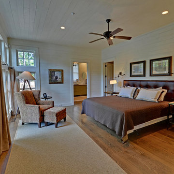
Envision Virtual Tours and High Resolution Photography is your best choice to find just what you are looking for in the Lake Burton Area . Knowing the areas and resources of Lake Burton is our specialty
Lake Burton is a 2,775 acre man-made lake with 62 miles of shoreline located in the northeastern corner of Georgia in Rabun County. It is the first lake in a five-lake series called the Tallulah River Watershed that follows the original course of the Tallulah River. The series of lakes starts with Lake Burton as the northernmost lake followed by Lake Seed, Lake Rabun, Lake Tallulah Falls and the eastern arm of Lake Tugalo (the western arm is formed by the Chattooga River. The lakes are owned and operated by the Georgia Power Company to generate hydroelectric energy for Georgia's largest city, Atlanta. At one time these lakes were the largest producers of electricity in the state of Georgia. Now, they only provide peak power supply.
The lake was built in a deep valley located along a 10 mile section of the Tallulah River. The Lake Burton Dam was closed on December 22, 1919 and the lake started to fill. The dam is a gravity concrete dam, with a height of 128 feet and a span of 1,100 feet. The spillway is equipped with eight gates 22 feet wide by 6.6 feet high. The total capacity at an elevation of 1,866.6 feet is 108,000 acre-ft, of which 106,000 acre-ft is usable storage. The generating capacity of the dam is 6,120 kilowatts (two units).Lake Burton is the highest Georgia Power lake in Georgia.
Lake Burton gets its named from the town of Burton, which was the second largest town in Rabun County with a population of approximately 200 but now lies below the lake's surface. The town (and the lake) was named after local prominent citizen Jeremiah Burton and was situated along the road from Clayton, Georgia to the Nacoochee Valley. Andrew Jackson Ritchie served as the postmaster for the area for several years. Gold was first discovered in Rabun County where Dicks Creek and the Tallulah River come together and was the reason for the town's founding in the early 1800s.
The Lake Burton Fish Hatchery and Moccasin Creek State Park are located on the western side of the lake. Lake Burton is home to several species of fish, including Spotted Bass, Largemouth Bass, White Bass, Black Crappie, Bluegill, Redear Sunfish, White Catfish, Walleye, Brown Trout, Rainbow Trout, and Yellow Perch.
The residents of Lake Burton are a mix of permanent residents and seasonal vacationers who together make-up the Lake Burton Civic Association, a local organization who goal is to maintain the lake through volunteer clean-ups and other such events. Let a Lake Burton resident and expert show you the way
The Lake Burton Civic Association is an active homeowners association for residents of the Lake Burton area and sponsors many events throughout the year such as:
burton, custom, envision, georgia, lake, mountain, nc, north, photography, web, western, Lake Burton, Lake Rabun, Seed Lake,Virtual Tours.
 Envision Web
Stuart Wade, Envision Virtual Tours, Inc.
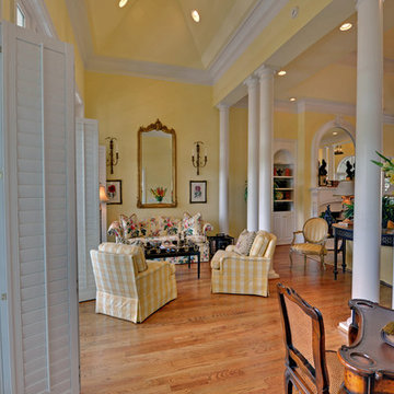
Envision Virtual Tours and High Resolution Photography is your best choice to find just what you are looking for in the Lake Burton Area . Knowing the areas and resources of Lake Burton is our specialty
Lake Burton is a 2,775 acre man-made lake with 62 miles of shoreline located in the northeastern corner of Georgia in Rabun County. It is the first lake in a five-lake series called the Tallulah River Watershed that follows the original course of the Tallulah River. The series of lakes starts with Lake Burton as the northernmost lake followed by Lake Seed, Lake Rabun, Lake Tallulah Falls and the eastern arm of Lake Tugalo (the western arm is formed by the Chattooga River. The lakes are owned and operated by the Georgia Power Company to generate hydroelectric energy for Georgia's largest city, Atlanta. At one time these lakes were the largest producers of electricity in the state of Georgia. Now, they only provide peak power supply.
The lake was built in a deep valley located along a 10 mile section of the Tallulah River. The Lake Burton Dam was closed on December 22, 1919 and the lake started to fill. The dam is a gravity concrete dam, with a height of 128 feet and a span of 1,100 feet. The spillway is equipped with eight gates 22 feet wide by 6.6 feet high. The total capacity at an elevation of 1,866.6 feet is 108,000 acre-ft, of which 106,000 acre-ft is usable storage. The generating capacity of the dam is 6,120 kilowatts (two units).Lake Burton is the highest Georgia Power lake in Georgia.
Lake Burton gets its named from the town of Burton, which was the second largest town in Rabun County with a population of approximately 200 but now lies below the lake's surface. The town (and the lake) was named after local prominent citizen Jeremiah Burton and was situated along the road from Clayton, Georgia to the Nacoochee Valley. Andrew Jackson Ritchie served as the postmaster for the area for several years. Gold was first discovered in Rabun County where Dicks Creek and the Tallulah River come together and was the reason for the town's founding in the early 1800s.
The Lake Burton Fish Hatchery and Moccasin Creek State Park are located on the western side of the lake. Lake Burton is home to several species of fish, including Spotted Bass, Largemouth Bass, White Bass, Black Crappie, Bluegill, Redear Sunfish, White Catfish, Walleye, Brown Trout, Rainbow Trout, and Yellow Perch.
The residents of Lake Burton are a mix of permanent residents and seasonal vacationers who together make-up the Lake Burton Civic Association, a local organization who goal is to maintain the lake through volunteer clean-ups and other such events. Let a Lake Burton resident and expert show you the way
The Lake Burton Civic Association is an active homeowners association for residents of the Lake Burton area and sponsors many events throughout the year such as:
burton, custom, envision, georgia, lake, mountain, nc, north, photography, web, western, Lake Burton, Lake Rabun, Seed Lake,Virtual Tours.
Find the right local pro for your project
 Envision Web
Stuart Wade, Envision Virtual Tours
The town of Blue Ridge offers eclectic shopping and dining in a quaint small town setting. With the historic Blue Ridge Depot at its center, Blue Ridge is a center for arts and galleries, antiques, unique shopping and eateries.
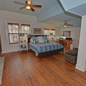
For capturing the best views of your home or cabin, Envision Virtual Tours is your professional and reliable choice for high resolution virtual tours and photos.
Blue Ridge was once considered an elite health resort because of its pure mineral waters. It was established as a railroad town, with the depot at its heart. Visitors would ride the train to town, eat dinner at the Blue Ridge Hotel, and take a leisurely walk to the mineral springs after dinner. Today's visitors still ride the train and take leisurely walks along Main Street, enjoying the antique and specialty shops, galleries, restaurants, small town atmosphere and friendly people of Blue Ridge. The town was founded in 1886 as a result of the arrival of the Marietta and North Georgia Railroad. In the early years, at different times, there were five hotels and several boarding houses in downtown Blue Ridge.
 Envision Web
Stuart Wade, Envision Virtual Tours, Inc.
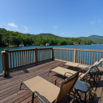
Envision Virtual Tours and High Resolution Photography is your best choice to find just what you are looking for in the Lake Burton Area . Knowing the areas and resources of Lake Burton is our specialty
Lake Burton is a 2,775 acre man-made lake with 62 miles of shoreline located in the northeastern corner of Georgia in Rabun County. It is the first lake in a five-lake series called the Tallulah River Watershed that follows the original course of the Tallulah River. The series of lakes starts with Lake Burton as the northernmost lake followed by Lake Seed, Lake Rabun, Lake Tallulah Falls and the eastern arm of Lake Tugalo (the western arm is formed by the Chattooga River. The lakes are owned and operated by the Georgia Power Company to generate hydroelectric energy for Georgia's largest city, Atlanta. At one time these lakes were the largest producers of electricity in the state of Georgia. Now, they only provide peak power supply.
The lake was built in a deep valley located along a 10 mile section of the Tallulah River. The Lake Burton Dam was closed on December 22, 1919 and the lake started to fill. The dam is a gravity concrete dam, with a height of 128 feet and a span of 1,100 feet. The spillway is equipped with eight gates 22 feet wide by 6.6 feet high. The total capacity at an elevation of 1,866.6 feet is 108,000 acre-ft, of which 106,000 acre-ft is usable storage. The generating capacity of the dam is 6,120 kilowatts (two units).Lake Burton is the highest Georgia Power lake in Georgia.
Lake Burton gets its named from the town of Burton, which was the second largest town in Rabun County with a population of approximately 200 but now lies below the lake's surface. The town (and the lake) was named after local prominent citizen Jeremiah Burton and was situated along the road from Clayton, Georgia to the Nacoochee Valley. Andrew Jackson Ritchie served as the postmaster for the area for several years. Gold was first discovered in Rabun County where Dicks Creek and the Tallulah River come together and was the reason for the town's founding in the early 1800s.
The Lake Burton Fish Hatchery and Moccasin Creek State Park are located on the western side of the lake. Lake Burton is home to several species of fish, including Spotted Bass, Largemouth Bass, White Bass, Black Crappie, Bluegill, Redear Sunfish, White Catfish, Walleye, Brown Trout, Rainbow Trout, and Yellow Perch.
The residents of Lake Burton are a mix of permanent residents and seasonal vacationers who together make-up the Lake Burton Civic Association, a local organization who goal is to maintain the lake through volunteer clean-ups and other such events. Let a Lake Burton resident and expert show you the way
The Lake Burton Civic Association is an active homeowners association for residents of the Lake Burton area and sponsors many events throughout the year such as:
burton, custom, envision, georgia, lake, mountain, nc, north, photography, web, western, Lake Burton, Lake Rabun, Seed Lake,Virtual Tours.
 Envision Web
Stuart Wade, Envision Virtual Tours, Inc.
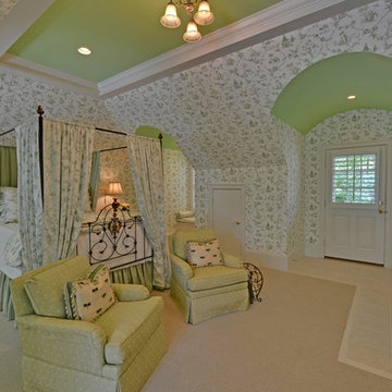
Envision Virtual Tours and High Resolution Photography is your best choice to find just what you are looking for in the Lake Burton Area . Knowing the areas and resources of Lake Burton is our specialty
Lake Burton is a 2,775 acre man-made lake with 62 miles of shoreline located in the northeastern corner of Georgia in Rabun County. It is the first lake in a five-lake series called the Tallulah River Watershed that follows the original course of the Tallulah River. The series of lakes starts with Lake Burton as the northernmost lake followed by Lake Seed, Lake Rabun, Lake Tallulah Falls and the eastern arm of Lake Tugalo (the western arm is formed by the Chattooga River. The lakes are owned and operated by the Georgia Power Company to generate hydroelectric energy for Georgia's largest city, Atlanta. At one time these lakes were the largest producers of electricity in the state of Georgia. Now, they only provide peak power supply.
The lake was built in a deep valley located along a 10 mile section of the Tallulah River. The Lake Burton Dam was closed on December 22, 1919 and the lake started to fill. The dam is a gravity concrete dam, with a height of 128 feet and a span of 1,100 feet. The spillway is equipped with eight gates 22 feet wide by 6.6 feet high. The total capacity at an elevation of 1,866.6 feet is 108,000 acre-ft, of which 106,000 acre-ft is usable storage. The generating capacity of the dam is 6,120 kilowatts (two units).Lake Burton is the highest Georgia Power lake in Georgia.
Lake Burton gets its named from the town of Burton, which was the second largest town in Rabun County with a population of approximately 200 but now lies below the lake's surface. The town (and the lake) was named after local prominent citizen Jeremiah Burton and was situated along the road from Clayton, Georgia to the Nacoochee Valley. Andrew Jackson Ritchie served as the postmaster for the area for several years. Gold was first discovered in Rabun County where Dicks Creek and the Tallulah River come together and was the reason for the town's founding in the early 1800s.
The Lake Burton Fish Hatchery and Moccasin Creek State Park are located on the western side of the lake. Lake Burton is home to several species of fish, including Spotted Bass, Largemouth Bass, White Bass, Black Crappie, Bluegill, Redear Sunfish, White Catfish, Walleye, Brown Trout, Rainbow Trout, and Yellow Perch.
The residents of Lake Burton are a mix of permanent residents and seasonal vacationers who together make-up the Lake Burton Civic Association, a local organization who goal is to maintain the lake through volunteer clean-ups and other such events. Let a Lake Burton resident and expert show you the way
The Lake Burton Civic Association is an active homeowners association for residents of the Lake Burton area and sponsors many events throughout the year such as:
burton, custom, envision, georgia, lake, mountain, nc, north, photography, web, western, Lake Burton, Lake Rabun, Seed Lake,Virtual Tours.
 Envision Web
Stuart Wade, Envision Virtual Tours
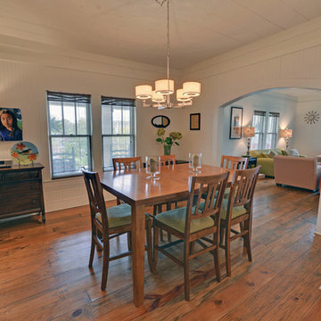
The town of Blue Ridge offers eclectic shopping and dining in a quaint small town setting. With the historic Blue Ridge Depot at its center, Blue Ridge is a center for arts and galleries, antiques, unique shopping and eateries.
For capturing the best views of your home or cabin, Envision Virtual Tours is your professional and reliable choice for high resolution virtual tours and photos.
Blue Ridge was once considered an elite health resort because of its pure mineral waters. It was established as a railroad town, with the depot at its heart. Visitors would ride the train to town, eat dinner at the Blue Ridge Hotel, and take a leisurely walk to the mineral springs after dinner. Today's visitors still ride the train and take leisurely walks along Main Street, enjoying the antique and specialty shops, galleries, restaurants, small town atmosphere and friendly people of Blue Ridge. The town was founded in 1886 as a result of the arrival of the Marietta and North Georgia Railroad. In the early years, at different times, there were five hotels and several boarding houses in downtown Blue Ridge.
Sponsored
Delaware, OH

Buckeye Basements, Inc.
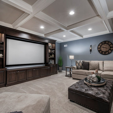
Central Ohio's Basement Finishing ExpertsBest Of Houzz '13-'21
 Envision Web
Stuart Wade, Envision Virtual Tours
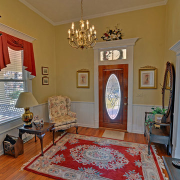
Envision Virtual Tours and High Resolution Photography is your best choice to find just what you are looking for in the Hartwell Area . Knowing the areas and resources of Lake Hartwell is our specialty. Whether you're looking for fishing on Lake Hartwell, information and history of Hartwell Dam and Lake. Learn all about Lake Hartwell here!
Hartwell, Ga. was the Reader's Choice 2009 Best small town to live in. Hartwell is the seat of Hart County and sits upon the southern border of Lake Hartwell. Lake Hartwell is a reservoir bordering Georgia and South Carolina on the Savannah, Tugaloo, and Seneca Rivers.
LAKE HARTWELL is located in the Northeast Georgia Mountains and Upcountry South Carolina. Formed by a Corps of Engineers dam at Hartwell, Georgia and bisected by Interstate 85 as it crosses from Georgia into South Carolina, Hartwell Lake is one of the most accessible lakes in the nation. Less than 2 hours from downtown Atlanta, GA, 2 hours from Charlotte, NC, or 1 hour from Greenville, SC, Lake Hartwell is an ideal location for your residence, retirement, vacation, or investment real estate. Lake Hartwell's 962 miles of shoreline and 56,000 acres feature over 80 public boat ramps, recreation, and park areas with some of the best boating, water-skiing, and fishing in Georgia or South Carolina. GOLF HARTWELL at one of the nearby courses, or just relax on a quiet island or one of many natural sand beaches. Lake Hartwell Water Level
 Envision Web
Stuart Wade, Envision Virtual Tours
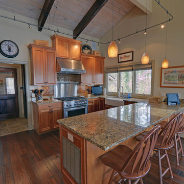
Envision Virtual Tours and High Resolution Photography is your best choice to find just what you are looking for in the Hartwell Area . Knowing the areas and resources of Lake Hartwell is our specialty. Whether you're looking for fishing on Lake Hartwell, information and history of Hartwell Dam and Lake. Learn all about Lake Hartwell here!
Hartwell, Ga. was the Reader's Choice 2009 Best small town to live in. Hartwell is the seat of Hart County and sits upon the southern border of Lake Hartwell. Lake Hartwell is a reservoir bordering Georgia and South Carolina on the Savannah, Tugaloo, and Seneca Rivers.
LAKE HARTWELL is located in the Northeast Georgia Mountains and Upcountry South Carolina. Formed by a Corps of Engineers dam at Hartwell, Georgia and bisected by Interstate 85 as it crosses from Georgia into South Carolina, Hartwell Lake is one of the most accessible lakes in the nation. Less than 2 hours from downtown Atlanta, GA, 2 hours from Charlotte, NC, or 1 hour from Greenville, SC, Lake Hartwell is an ideal location for your residence, retirement, vacation, or investment real estate. Lake Hartwell's 962 miles of shoreline and 56,000 acres feature over 80 public boat ramps, recreation, and park areas with some of the best boating, water-skiing, and fishing in Georgia or South Carolina. GOLF HARTWELL at one of the nearby courses, or just relax on a quiet island or one of many natural sand beaches. Lake Hartwell Water Level
 Envision Web
Stuart Wade, Envision Virtual Tours
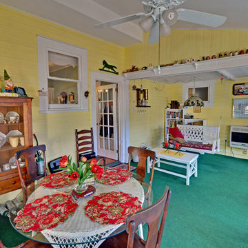
Envision Virtual Tours and High Resolution Photography is your best choice to find just what you are looking for in the Hartwell Area . Knowing the areas and resources of Lake Hartwell is our specialty. Whether you're looking for fishing on Lake Hartwell, information and history of Hartwell Dam and Lake. Learn all about Lake Hartwell here!
Hartwell, Ga. was the Reader's Choice 2009 Best small town to live in. Hartwell is the seat of Hart County and sits upon the southern border of Lake Hartwell. Lake Hartwell is a reservoir bordering Georgia and South Carolina on the Savannah, Tugaloo, and Seneca Rivers.
LAKE HARTWELL is located in the Northeast Georgia Mountains and Upcountry South Carolina. Formed by a Corps of Engineers dam at Hartwell, Georgia and bisected by Interstate 85 as it crosses from Georgia into South Carolina, Hartwell Lake is one of the most accessible lakes in the nation. Less than 2 hours from downtown Atlanta, GA, 2 hours from Charlotte, NC, or 1 hour from Greenville, SC, Lake Hartwell is an ideal location for your residence, retirement, vacation, or investment real estate. Lake Hartwell's 962 miles of shoreline and 56,000 acres feature over 80 public boat ramps, recreation, and park areas with some of the best boating, water-skiing, and fishing in Georgia or South Carolina. GOLF HARTWELL at one of the nearby courses, or just relax on a quiet island or one of many natural sand beaches. Lake Hartwell Water Level
 Envision Web
Stuart Wade, Envision Virtual Tours
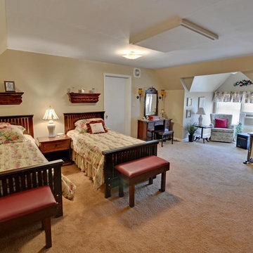
Envision Virtual Tours and High Resolution Photography is your best choice to find just what you are looking for in the Hartwell Area . Knowing the areas and resources of Lake Hartwell is our specialty. Whether you're looking for fishing on Lake Hartwell, information and history of Hartwell Dam and Lake. Learn all about Lake Hartwell here!
Hartwell, Ga. was the Reader's Choice 2009 Best small town to live in. Hartwell is the seat of Hart County and sits upon the southern border of Lake Hartwell. Lake Hartwell is a reservoir bordering Georgia and South Carolina on the Savannah, Tugaloo, and Seneca Rivers.
LAKE HARTWELL is located in the Northeast Georgia Mountains and Upcountry South Carolina. Formed by a Corps of Engineers dam at Hartwell, Georgia and bisected by Interstate 85 as it crosses from Georgia into South Carolina, Hartwell Lake is one of the most accessible lakes in the nation. Less than 2 hours from downtown Atlanta, GA, 2 hours from Charlotte, NC, or 1 hour from Greenville, SC, Lake Hartwell is an ideal location for your residence, retirement, vacation, or investment real estate. Lake Hartwell's 962 miles of shoreline and 56,000 acres feature over 80 public boat ramps, recreation, and park areas with some of the best boating, water-skiing, and fishing in Georgia or South Carolina. GOLF HARTWELL at one of the nearby courses, or just relax on a quiet island or one of many natural sand beaches. Lake Hartwell Water Level
 Envision Web
Stuart Wade, Envision Virtual Tours
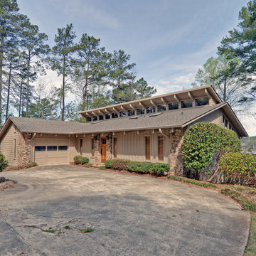
Envision Virtual Tours and High Resolution Photography is your best choice to find just what you are looking for in the Hartwell Area . Knowing the areas and resources of Lake Hartwell is our specialty. Whether you're looking for fishing on Lake Hartwell, information and history of Hartwell Dam and Lake. Learn all about Lake Hartwell here!
Hartwell, Ga. was the Reader's Choice 2009 Best small town to live in. Hartwell is the seat of Hart County and sits upon the southern border of Lake Hartwell. Lake Hartwell is a reservoir bordering Georgia and South Carolina on the Savannah, Tugaloo, and Seneca Rivers.
LAKE HARTWELL is located in the Northeast Georgia Mountains and Upcountry South Carolina. Formed by a Corps of Engineers dam at Hartwell, Georgia and bisected by Interstate 85 as it crosses from Georgia into South Carolina, Hartwell Lake is one of the most accessible lakes in the nation. Less than 2 hours from downtown Atlanta, GA, 2 hours from Charlotte, NC, or 1 hour from Greenville, SC, Lake Hartwell is an ideal location for your residence, retirement, vacation, or investment real estate. Lake Hartwell's 962 miles of shoreline and 56,000 acres feature over 80 public boat ramps, recreation, and park areas with some of the best boating, water-skiing, and fishing in Georgia or South Carolina. GOLF HARTWELL at one of the nearby courses, or just relax on a quiet island or one of many natural sand beaches. Lake Hartwell Water Level
 Envision Web
Stuart Wade, Envision Virtual Tours, Inc.
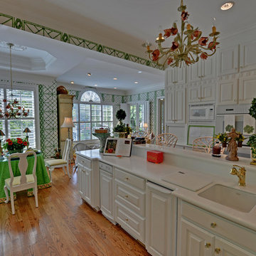
Envision Virtual Tours and High Resolution Photography is your best choice to find just what you are looking for in the Lake Burton Area . Knowing the areas and resources of Lake Burton is our specialty
Lake Burton is a 2,775 acre man-made lake with 62 miles of shoreline located in the northeastern corner of Georgia in Rabun County. It is the first lake in a five-lake series called the Tallulah River Watershed that follows the original course of the Tallulah River. The series of lakes starts with Lake Burton as the northernmost lake followed by Lake Seed, Lake Rabun, Lake Tallulah Falls and the eastern arm of Lake Tugalo (the western arm is formed by the Chattooga River. The lakes are owned and operated by the Georgia Power Company to generate hydroelectric energy for Georgia's largest city, Atlanta. At one time these lakes were the largest producers of electricity in the state of Georgia. Now, they only provide peak power supply.
The lake was built in a deep valley located along a 10 mile section of the Tallulah River. The Lake Burton Dam was closed on December 22, 1919 and the lake started to fill. The dam is a gravity concrete dam, with a height of 128 feet and a span of 1,100 feet. The spillway is equipped with eight gates 22 feet wide by 6.6 feet high. The total capacity at an elevation of 1,866.6 feet is 108,000 acre-ft, of which 106,000 acre-ft is usable storage. The generating capacity of the dam is 6,120 kilowatts (two units).Lake Burton is the highest Georgia Power lake in Georgia.
Lake Burton gets its named from the town of Burton, which was the second largest town in Rabun County with a population of approximately 200 but now lies below the lake's surface. The town (and the lake) was named after local prominent citizen Jeremiah Burton and was situated along the road from Clayton, Georgia to the Nacoochee Valley. Andrew Jackson Ritchie served as the postmaster for the area for several years. Gold was first discovered in Rabun County where Dicks Creek and the Tallulah River come together and was the reason for the town's founding in the early 1800s.
The Lake Burton Fish Hatchery and Moccasin Creek State Park are located on the western side of the lake. Lake Burton is home to several species of fish, including Spotted Bass, Largemouth Bass, White Bass, Black Crappie, Bluegill, Redear Sunfish, White Catfish, Walleye, Brown Trout, Rainbow Trout, and Yellow Perch.
The residents of Lake Burton are a mix of permanent residents and seasonal vacationers who together make-up the Lake Burton Civic Association, a local organization who goal is to maintain the lake through volunteer clean-ups and other such events. Let a Lake Burton resident and expert show you the way
The Lake Burton Civic Association is an active homeowners association for residents of the Lake Burton area and sponsors many events throughout the year such as:
burton, custom, envision, georgia, lake, mountain, nc, north, photography, web, western, Lake Burton, Lake Rabun, Seed Lake,Virtual Tours.
 Envision Web
Stuart Wade, Envision Virtual Tours
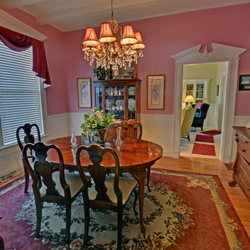
Envision Virtual Tours and High Resolution Photography is your best choice to find just what you are looking for in the Hartwell Area . Knowing the areas and resources of Lake Hartwell is our specialty. Whether you're looking for fishing on Lake Hartwell, information and history of Hartwell Dam and Lake. Learn all about Lake Hartwell here!
Hartwell, Ga. was the Reader's Choice 2009 Best small town to live in. Hartwell is the seat of Hart County and sits upon the southern border of Lake Hartwell. Lake Hartwell is a reservoir bordering Georgia and South Carolina on the Savannah, Tugaloo, and Seneca Rivers.
LAKE HARTWELL is located in the Northeast Georgia Mountains and Upcountry South Carolina. Formed by a Corps of Engineers dam at Hartwell, Georgia and bisected by Interstate 85 as it crosses from Georgia into South Carolina, Hartwell Lake is one of the most accessible lakes in the nation. Less than 2 hours from downtown Atlanta, GA, 2 hours from Charlotte, NC, or 1 hour from Greenville, SC, Lake Hartwell is an ideal location for your residence, retirement, vacation, or investment real estate. Lake Hartwell's 962 miles of shoreline and 56,000 acres feature over 80 public boat ramps, recreation, and park areas with some of the best boating, water-skiing, and fishing in Georgia or South Carolina. GOLF HARTWELL at one of the nearby courses, or just relax on a quiet island or one of many natural sand beaches. Lake Hartwell Water Level
 Envision Web
Stuart Wade, Envision Virtual Tours, Inc.
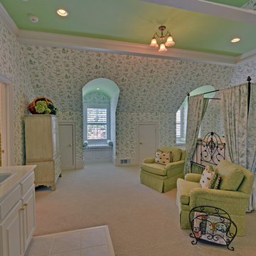
Envision Virtual Tours and High Resolution Photography is your best choice to find just what you are looking for in the Lake Burton Area . Knowing the areas and resources of Lake Burton is our specialty
Lake Burton is a 2,775 acre man-made lake with 62 miles of shoreline located in the northeastern corner of Georgia in Rabun County. It is the first lake in a five-lake series called the Tallulah River Watershed that follows the original course of the Tallulah River. The series of lakes starts with Lake Burton as the northernmost lake followed by Lake Seed, Lake Rabun, Lake Tallulah Falls and the eastern arm of Lake Tugalo (the western arm is formed by the Chattooga River. The lakes are owned and operated by the Georgia Power Company to generate hydroelectric energy for Georgia's largest city, Atlanta. At one time these lakes were the largest producers of electricity in the state of Georgia. Now, they only provide peak power supply.
The lake was built in a deep valley located along a 10 mile section of the Tallulah River. The Lake Burton Dam was closed on December 22, 1919 and the lake started to fill. The dam is a gravity concrete dam, with a height of 128 feet and a span of 1,100 feet. The spillway is equipped with eight gates 22 feet wide by 6.6 feet high. The total capacity at an elevation of 1,866.6 feet is 108,000 acre-ft, of which 106,000 acre-ft is usable storage. The generating capacity of the dam is 6,120 kilowatts (two units).Lake Burton is the highest Georgia Power lake in Georgia.
Lake Burton gets its named from the town of Burton, which was the second largest town in Rabun County with a population of approximately 200 but now lies below the lake's surface. The town (and the lake) was named after local prominent citizen Jeremiah Burton and was situated along the road from Clayton, Georgia to the Nacoochee Valley. Andrew Jackson Ritchie served as the postmaster for the area for several years. Gold was first discovered in Rabun County where Dicks Creek and the Tallulah River come together and was the reason for the town's founding in the early 1800s.
The Lake Burton Fish Hatchery and Moccasin Creek State Park are located on the western side of the lake. Lake Burton is home to several species of fish, including Spotted Bass, Largemouth Bass, White Bass, Black Crappie, Bluegill, Redear Sunfish, White Catfish, Walleye, Brown Trout, Rainbow Trout, and Yellow Perch.
The residents of Lake Burton are a mix of permanent residents and seasonal vacationers who together make-up the Lake Burton Civic Association, a local organization who goal is to maintain the lake through volunteer clean-ups and other such events. Let a Lake Burton resident and expert show you the way
The Lake Burton Civic Association is an active homeowners association for residents of the Lake Burton area and sponsors many events throughout the year such as:
burton, custom, envision, georgia, lake, mountain, nc, north, photography, web, western, Lake Burton, Lake Rabun, Seed Lake,Virtual Tours.
 Envision Web
Stuart Wade, Envision Virtual Tours, Inc.
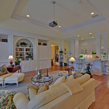
Envision Virtual Tours and High Resolution Photography is your best choice to find just what you are looking for in the Lake Burton Area . Knowing the areas and resources of Lake Burton is our specialty
Lake Burton is a 2,775 acre man-made lake with 62 miles of shoreline located in the northeastern corner of Georgia in Rabun County. It is the first lake in a five-lake series called the Tallulah River Watershed that follows the original course of the Tallulah River. The series of lakes starts with Lake Burton as the northernmost lake followed by Lake Seed, Lake Rabun, Lake Tallulah Falls and the eastern arm of Lake Tugalo (the western arm is formed by the Chattooga River. The lakes are owned and operated by the Georgia Power Company to generate hydroelectric energy for Georgia's largest city, Atlanta. At one time these lakes were the largest producers of electricity in the state of Georgia. Now, they only provide peak power supply.
The lake was built in a deep valley located along a 10 mile section of the Tallulah River. The Lake Burton Dam was closed on December 22, 1919 and the lake started to fill. The dam is a gravity concrete dam, with a height of 128 feet and a span of 1,100 feet. The spillway is equipped with eight gates 22 feet wide by 6.6 feet high. The total capacity at an elevation of 1,866.6 feet is 108,000 acre-ft, of which 106,000 acre-ft is usable storage. The generating capacity of the dam is 6,120 kilowatts (two units).Lake Burton is the highest Georgia Power lake in Georgia.
Lake Burton gets its named from the town of Burton, which was the second largest town in Rabun County with a population of approximately 200 but now lies below the lake's surface. The town (and the lake) was named after local prominent citizen Jeremiah Burton and was situated along the road from Clayton, Georgia to the Nacoochee Valley. Andrew Jackson Ritchie served as the postmaster for the area for several years. Gold was first discovered in Rabun County where Dicks Creek and the Tallulah River come together and was the reason for the town's founding in the early 1800s.
The Lake Burton Fish Hatchery and Moccasin Creek State Park are located on the western side of the lake. Lake Burton is home to several species of fish, including Spotted Bass, Largemouth Bass, White Bass, Black Crappie, Bluegill, Redear Sunfish, White Catfish, Walleye, Brown Trout, Rainbow Trout, and Yellow Perch.
The residents of Lake Burton are a mix of permanent residents and seasonal vacationers who together make-up the Lake Burton Civic Association, a local organization who goal is to maintain the lake through volunteer clean-ups and other such events. Let a Lake Burton resident and expert show you the way
The Lake Burton Civic Association is an active homeowners association for residents of the Lake Burton area and sponsors many events throughout the year such as:
burton, custom, envision, georgia, lake, mountain, nc, north, photography, web, western, Lake Burton, Lake Rabun, Seed Lake,Virtual Tours.
 Envision Web
Stuart Wade, Envision Virtual Tours, Inc.
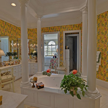
Envision Virtual Tours and High Resolution Photography is your best choice to find just what you are looking for in the Lake Burton Area . Knowing the areas and resources of Lake Burton is our specialty
Lake Burton is a 2,775 acre man-made lake with 62 miles of shoreline located in the northeastern corner of Georgia in Rabun County. It is the first lake in a five-lake series called the Tallulah River Watershed that follows the original course of the Tallulah River. The series of lakes starts with Lake Burton as the northernmost lake followed by Lake Seed, Lake Rabun, Lake Tallulah Falls and the eastern arm of Lake Tugalo (the western arm is formed by the Chattooga River. The lakes are owned and operated by the Georgia Power Company to generate hydroelectric energy for Georgia's largest city, Atlanta. At one time these lakes were the largest producers of electricity in the state of Georgia. Now, they only provide peak power supply.
The lake was built in a deep valley located along a 10 mile section of the Tallulah River. The Lake Burton Dam was closed on December 22, 1919 and the lake started to fill. The dam is a gravity concrete dam, with a height of 128 feet and a span of 1,100 feet. The spillway is equipped with eight gates 22 feet wide by 6.6 feet high. The total capacity at an elevation of 1,866.6 feet is 108,000 acre-ft, of which 106,000 acre-ft is usable storage. The generating capacity of the dam is 6,120 kilowatts (two units).Lake Burton is the highest Georgia Power lake in Georgia.
Lake Burton gets its named from the town of Burton, which was the second largest town in Rabun County with a population of approximately 200 but now lies below the lake's surface. The town (and the lake) was named after local prominent citizen Jeremiah Burton and was situated along the road from Clayton, Georgia to the Nacoochee Valley. Andrew Jackson Ritchie served as the postmaster for the area for several years. Gold was first discovered in Rabun County where Dicks Creek and the Tallulah River come together and was the reason for the town's founding in the early 1800s.
The Lake Burton Fish Hatchery and Moccasin Creek State Park are located on the western side of the lake. Lake Burton is home to several species of fish, including Spotted Bass, Largemouth Bass, White Bass, Black Crappie, Bluegill, Redear Sunfish, White Catfish, Walleye, Brown Trout, Rainbow Trout, and Yellow Perch.
The residents of Lake Burton are a mix of permanent residents and seasonal vacationers who together make-up the Lake Burton Civic Association, a local organization who goal is to maintain the lake through volunteer clean-ups and other such events. Let a Lake Burton resident and expert show you the way
The Lake Burton Civic Association is an active homeowners association for residents of the Lake Burton area and sponsors many events throughout the year such as:
burton, custom, envision, georgia, lake, mountain, nc, north, photography, web, western, Lake Burton, Lake Rabun, Seed Lake,Virtual Tours.
 Envision Web
Stuart Wade, Envision Virtual Tours
The town of Blue Ridge offers eclectic shopping and dining in a quaint small town setting. With the historic Blue Ridge Depot at its center, Blue Ridge is a center for arts and galleries, antiques, unique shopping and eateries.
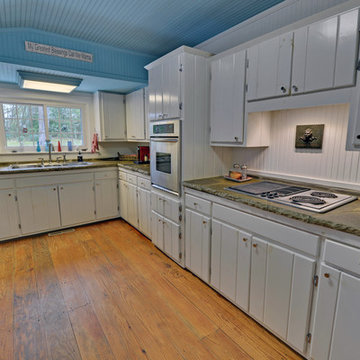
For capturing the best views of your home or cabin, Envision Virtual Tours is your professional and reliable choice for high resolution virtual tours and photos.
Blue Ridge was once considered an elite health resort because of its pure mineral waters. It was established as a railroad town, with the depot at its heart. Visitors would ride the train to town, eat dinner at the Blue Ridge Hotel, and take a leisurely walk to the mineral springs after dinner. Today's visitors still ride the train and take leisurely walks along Main Street, enjoying the antique and specialty shops, galleries, restaurants, small town atmosphere and friendly people of Blue Ridge. The town was founded in 1886 as a result of the arrival of the Marietta and North Georgia Railroad. In the early years, at different times, there were five hotels and several boarding houses in downtown Blue Ridge.
 Envision Web
Stuart Wade, Envision Virtual Tours
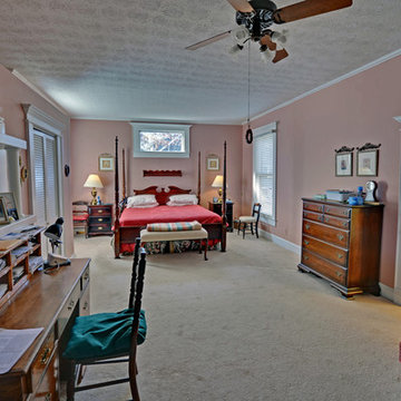
Envision Virtual Tours and High Resolution Photography is your best choice to find just what you are looking for in the Hartwell Area . Knowing the areas and resources of Lake Hartwell is our specialty. Whether you're looking for fishing on Lake Hartwell, information and history of Hartwell Dam and Lake. Learn all about Lake Hartwell here!
Hartwell, Ga. was the Reader's Choice 2009 Best small town to live in. Hartwell is the seat of Hart County and sits upon the southern border of Lake Hartwell. Lake Hartwell is a reservoir bordering Georgia and South Carolina on the Savannah, Tugaloo, and Seneca Rivers.
LAKE HARTWELL is located in the Northeast Georgia Mountains and Upcountry South Carolina. Formed by a Corps of Engineers dam at Hartwell, Georgia and bisected by Interstate 85 as it crosses from Georgia into South Carolina, Hartwell Lake is one of the most accessible lakes in the nation. Less than 2 hours from downtown Atlanta, GA, 2 hours from Charlotte, NC, or 1 hour from Greenville, SC, Lake Hartwell is an ideal location for your residence, retirement, vacation, or investment real estate. Lake Hartwell's 962 miles of shoreline and 56,000 acres feature over 80 public boat ramps, recreation, and park areas with some of the best boating, water-skiing, and fishing in Georgia or South Carolina. GOLF HARTWELL at one of the nearby courses, or just relax on a quiet island or one of many natural sand beaches. Lake Hartwell Water Level
 Envision Web
Stuart Wade, Envision Virtual Tours
The town of Blue Ridge offers eclectic shopping and dining in a quaint small town setting. With the historic Blue Ridge Depot at its center, Blue Ridge is a center for arts and galleries, antiques, unique shopping and eateries.
For capturing the best views of your home or cabin, Envision Virtual Tours is your professional and reliable choice for high resolution virtual tours and photos.
Blue Ridge was once considered an elite health resort because of its pure mineral waters. It was established as a railroad town, with the depot at its heart. Visitors would ride the train to town, eat dinner at the Blue Ridge Hotel, and take a leisurely walk to the mineral springs after dinner. Today's visitors still ride the train and take leisurely walks along Main Street, enjoying the antique and specialty shops, galleries, restaurants, small town atmosphere and friendly people of Blue Ridge. The town was founded in 1886 as a result of the arrival of the Marietta and North Georgia Railroad. In the early years, at different times, there were five hotels and several boarding houses in downtown Blue Ridge.
8