

Soil survey maps
19 years ago
Sort by:Oldest
Comments (7)
Related Stories
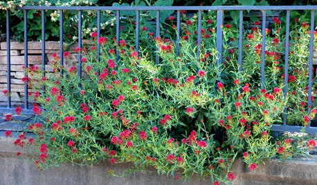
GARDENING GUIDESGrow a Beautiful Garden in Alkaline Soil
Got alkaline soil? Learn how to manage it and the many beautiful plants that will thrive in this ‘sweet’ soil
Full Story
GARDENING AND LANDSCAPINGHouzz Survey: See What Homeowners Are Doing With Their Landscapes Now
Homeowners are busy putting in low-maintenance landscapes designed for outdoor living, according to the 2015 Houzz landscaping survey
Full Story
INSIDE HOUZZA New Houzz Survey Reveals What You Really Want in Your Kitchen
Discover what Houzzers are planning for their new kitchens and which features are falling off the design radar
Full Story
Houzz Survey: Livability Trumps Home Value
Increasing home value comes in a distant second among those planning home improvements. Many plan to do some of the work themselves
Full Story
GARDENING GUIDESGet the Dirt on Your Garden’s Soil
Understand how your soil supports your plants so you can ensure your garden’s success
Full Story
ARCHITECTUREWant to Live by the Water? What You Need to Know
Waterside homes can have amazing charm, but you'll have to weather design restrictions, codes and surveys
Full Story
THE ART OF ARCHITECTUREFinding the Perfect Home for a New House
Sun, soil, water, topography and more offer important cues to siting your house on the land
Full Story
REMODELING GUIDESHow to Remodel Your Relationship While Remodeling Your Home
A new Houzz survey shows how couples cope with stress and make tough choices during building and decorating projects
Full Story
GARDENING GUIDESHow to Find the Right Native Plants for Your Yard
Find plant maps, sale sites and guides that make going native in the garden easier than ever
Full Story
INSIDE HOUZZInside Houzz: New Data Offer Insights on Landscaping Trends
Homeowners are looking to manage water and add more enjoyment to their landscapes, according to a new Houzz survey
Full Story
justaguy2
fertilizersalesman
Related Professionals
Cape Coral Landscape Architects & Landscape Designers · Bloomington Landscape Architects & Landscape Designers · Worcester Landscape Architects & Landscape Designers · Colorado Springs Landscape Architects & Landscape Designers · Saint Joseph Landscape Contractors · Asheville Landscape Contractors · Enid Landscape Contractors · Bloomington Landscape Contractors · Niles Landscape Contractors · Kearney Landscape Contractors · Santa Fe Landscape Contractors · Covington Architects & Building Designers · Austin Architects & Building Designers · Sarnia Architects & Building Designers · Bronx Architects & Building DesignersDibbit
justaguy2
rhizo_1 (North AL) zone 7
dchall_san_antonio
rhizo_1 (North AL) zone 7