Software
Houzz Logo Print
hmhausman

Florida Winter 2010-2011

16 years ago

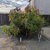
Thought I would memorialize our first cold snap of the season for future reference especially related to blooming cycles of mangoes and lychees/longans. We have had a relatively dry period for a period of about three weeks since Fall began. Then that was followed by a couple of rainy days with 1- 1 1/2 inches of rain falling in each event. Tonight our first real cold front is coming through with temps supposedly to be in the upper 40's for a couple of mornings. Some lychees have just flushed with new leaves.

Comments (11)

  • 16 years ago
    last modified: 11 years ago

    Hey Harry, we're forecasted (depending on which weather station) I go too...Weather Underground has me at 36° and W.com says 43° for tomorrow morning. I honestly hope this is not a sign of what winter weather lies ahead,lol...

    On a good note, we finally had some rain after 4 weeks of NO rain whatsoever...we got a little over 2" yesterday...Yay!!

  • 16 years ago
    last modified: 11 years ago

    La Niña likely to produce drier winter in SWFL
    Posted: Oct 19, 2010 1:55 PM EST Updated: Oct 19, 2010 1:59 PM EST

    By Meteorologist Morgan Palmer

    Over the past few months, we have been tracking the intensification of La Niña, or cooling of ocean waters across the Equatorial Pacific.

    We know that the presence of La Niña (or El Niño, which is warming of those waters) often produces a direct and noticable effect on weather patterns across the United States and across much of the Atlantic Basin.

    La Niña was a factor in the more active-than-normal hurricane season in the Atlantic, and the effects are often pronounced on wintertime weather as well.

    Strong probability for drier-than-normal Florida weather

    The official forecasts from the Climate Prediction Center and the South Florida National Weather Service forecast office (released today, release here) as well as looking at previous seasons when La Niña was in a moderate to strong phase indicate that most of Florida can expect less precipitation than is typical.

    As an average, Southwest Florida receives between 1.5 and 2.5 inches of rainfall each month from December to April.

    This is defined as the "dry season" or the "fire danger season."

    A reduction in that already scant rainfall could result in a more significant risk of brush fires across our area as we move into the warmer months of Spring.

    Result of La Niña on weather patterns

    A moderate-to-strong La Niña tends to produce stronger than normal high pressure across the southeast U.S. and western Atlantic Ocean.

    That is a result in a northward path of the polar jet stream across the higher latitudes of the continental U.S.

    In short, stormy weather and strong cold fronts tend to stay well to our north. And, when cold fronts get south toward Florida, they are either weaker or have little moisture to work with.

    Temperature outlook

    With this predicted La Niña expected to persist well into 2011, it is less likely that we'll have a repeat of the unusually cold winter of 2009-2010. In fact, our winter could turn out to be a bit warmer than normal.

    --------------------

    drier seasons arent always a bad thing for fruit trees, may help the lychees go into a good dormancy before spring showers

    Here is a link that might be useful: La Niña likely to produce drier winter in SWFL

  • 16 years ago
    last modified: 11 years ago

    You're getting a drier winter but we're gonna get at least 7" more rainfall than normal. I believe it too!
    I sure do hope your mangoes, lychees & logans does well for ya Harry and that we'll all have a very mild winter.

    Bo

  • 16 years ago
    last modified: 11 years ago

    Thanks Mango kush for posting that very informative article. I really, really hope their predictions holds true! We can definitely use a break from last winter's brutal weather.

    Hi Bo! Good luck with your fruit trees this winter as well!

  • 16 years ago
    last modified: 11 years ago

    My prediction is a 2011 with less precipitation late winter and spring and much better mango production than 2010. It is very dry today and for a few more

  • 16 years ago
    last modified: 11 years ago

    We have been having some super crazy weather here in San Diego. We got 100F temps the last two days which is making my small mango trees swell at the leaf nodes with possibly some new growth. I hope the new growth can harden before the cold weather hits.

  • 16 years ago
    last modified: 11 years ago

    Not Florida weather but we have had our first killing frost in western NY this fall. Interestingly enough it killed all my plants and even my basjoo banana but NOT the 'Cogshall' mango that I decided to let die due to major crack and decline in health. I really expected to see it die when we had a full night of 26 degree temps.

    On the positive not, my Maha Chinook mango continues to flourish under my new 600 watt HPS light set up. I followed instructions from friends here and from Frankies nursery where I bought it from. They told me to give it about 2 months before I pruned it to get branching and I did that. I ended up with 8 new branches + another on the way and now those 8 branches are hardening off!!!

    I really am pleased with this light set up. I have yet to see any big decline with my tropical fruit trees and in fact, I have around 200 buds on my dwarf keylime tree.
    I will start a thread in around Christmas to document my progress. I can't wait for my first mang fruits! This fruit is a solid A++! I will have to buy a couple more dwarf mango trees this coming year.
    Andrew

  • 16 years ago
    last modified: 11 years ago

    Winter Forecast 2010-2011: Heavier Snow for Chicago, Minneapolis and Detroit, Normal Snowfall for NYC, Philly and D.C.
    Sep 8, 2010; 4:52 PM ET

    The major metropolitan areas of the mid-Atlantic that were pummeled with snow last year will get a break this winter, but that doesn't mean there will be no snow to shovel. In contrast, Chicago, Milwaukee and Minneapolis could be in the heaviest snow zone this upcoming winter.

    Winter's Worst Cold and Snow

    Overall, AccuWeather.com Chief Long-Range Meteorologist Joe Bastardi is predicting that the worst of winter's cold and snow will be from the Pacific Northwest into the northern Plains and western Great Lakes. That will put cities like Portland and Seattle that escaped with a very nice winter last year, colder and snowier this year. Fargo and Minneapolis to Green Bay will also receive above-normal winter snowfall.

    Other cities predicted to receive above-normal winter snowfall include Chicago, Omaha, Minneapolis, Detroit, Cleveland, Seattle and Portland.

    Bastardi predicts severe cold will hit Alaska and western and central Canada.

    "The Canadian winter will be as harsh as last year's was gentle," Bastardi said.

    Wintry Battle Zone But No Snowmageddon

    In general, the East Coast will be granted a reprieve from the tremendous snowfall that caused 2009-2010's winter to be dubbed "snowmageddon."

    This does not mean a free pass for the Northeast. Bastardi predicts late November and December could get winter off to a fast start in the East, with a major thaw coming for much of the country in January.

    Bastardi makes the early cold connection between this year's active hurricane season and his winter forecast.

    He said that years that see significant landfall, such as 1995, 2008 and 2005, usually also have cold for much of the eastern and central portions of the nation in December.

    He said this year from the central Rockies to the Northeast a higher variance of temperatures will be present - "greater-than-normal swings between winter's coldest and warmest days." The conflicting warm and cold air masses contributing to these temperature fluctuations have placed this area into what Bastardi calls the "Wintry Battle Zone."

    Despite the wild swings in temperatures, cities like New York, Philadelphia and Washington, D.C., will still have near-normal snowfall. To put this in perspective, New York City receives an average of 28.4 inches of snowfall during winter.

    Warmer and Drier South

    The South and southern Plains will escape the worst of the winter weather with warmer and drier conditions compared to last year. Dallas, which received near-record snowfall last year, will be lucky to get normal snowfall this year.

    While these areas will be warmer and drier, this does not preclude the southern Plains and South from the threat of a couple of ice storms, as cold air tries to intrude southward.

    The best weather this winter will be in Florida. Bastardi suggests that Florida will be a great winter destination, with warmer-than-normal temperatures all winter long. We will also see warmer weather all along the Gulf coast, which could help the beach resorts recover from the economic downturn associated with the oil spill.

    Southern California May Suffer from Drought

    Southern California and portions of the Southwest could be threatened by a severe drought and high danger for wildfires, as Bastardi predicts a much drier-than-normal winter season for the region.

    According to AccuWeather.com Senior Meteorologist and West Coast Expert Ken Clark, strict water management for Southern California could result come next spring and summer.

    However, Bastardi predicts that from San Francisco and areas to the north, there could be more precipitation.

    "This may be a great winter for building the Pacific Northwest and Canada snowpack, which is opposite of last winter," said Bastardi.

    Temperatures this Winter

    Temperature-wise, Bastardi is forecasting slightly higher-than-normal temperatures (0.5 to 1 degree warmer) for Boston, Washington, D.C., and New York City.

    Detroit, Chicago, Kansas City and Minneapolis will be a degree or so cooler than average, while much of the western part of the nation may see temperatures that dip a couple of degrees.

    Bastardi said Salt Lake City could be as much as 1-3 degrees colder, while Denver will be about 2 degrees below normal and both San Francisco and Los Angeles will have temperatures about 1.5 degrees cooler.

    Above-normal snowfall is predicted for the Great Basin region, the Northwest and northern Plains, while the South and Southwest will get less snow than average.

    Story by Kirstie Hettinga, Carly Porter and Henry Margusity, AccuWeather.com Staff Writers.

  • 16 years ago
    last modified: 11 years ago

    Thanks Bluepalm for posting...very informative and let's hope they are right in their predictions for us in FL!
    We need the break, especially our Tropical Fruit trees!

  • 16 years ago
    last modified: 11 years ago

    Andrew, so glad to hear you're very happy with your Maha Chinook mango tree, and with your HPS light set up. Sorry to hear that your Cogshall declining...Good luck with all your trees!

  • 16 years ago
    last modified: 11 years ago

    Joe Bastardi's forecast for Florida turned out to be very accurate for last winter, so let's see how he does on this one!

Sponsored
Peabody Landscape Group
Average rating: 3.5 out of 5 stars8 Reviews
Franklin County's Reliable Landscape Design & Contracting