
Search results for "State's real" in Home Design Ideas
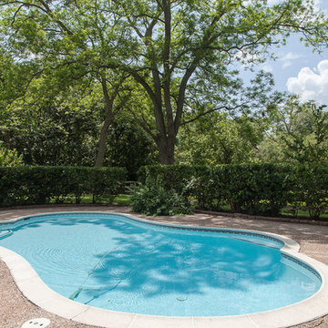
 Daria Ratliff Photography
Daria Ratliff Photography Real State Photo Job
Inspiration for a country backyard pool remodel in Houston
Inspiration for a country backyard pool remodel in Houston
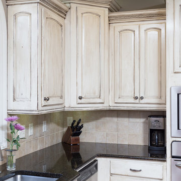
 Tommy Daspit Photographer
Tommy Daspit
Tommy Daspit is an Architectural, Commercial, Real Estate, and Google Maps Business View Trusted photographer in Birmingham, Alabama. Tommy provides the best in commercial photography in the southeastern United States (Alabama, Georgia, North Carolina, South Carolina, Florida, Mississippi, Louisiana, and Tennessee).View more of his work on his homepage: http://tommmydaspit.com/
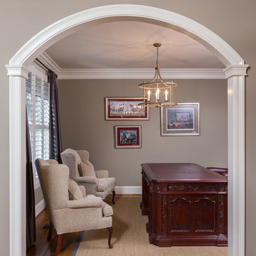 Tommy Daspit Photographer
Tommy Daspit
Tommy Daspit is an Architectural, Commercial, Real Estate, and Google Maps Business View Trusted photographer in Birmingham, Alabama. Tommy provides the best in commercial photography in the southeastern United States (Alabama, Georgia, North Carolina, South Carolina, Florida, Mississippi, Louisiana, and Tennessee).View more of his work on his homepage: http://tommmydaspit.com/
Find the right local pro for your project
 RealCraft
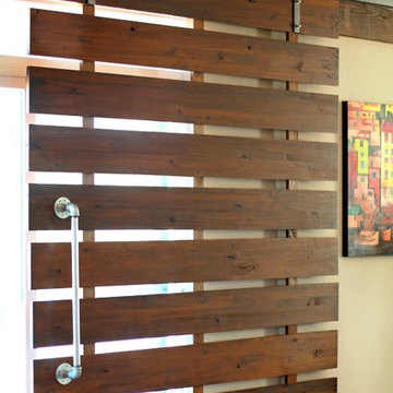
This slatted sliding door was created as a way to control the sun. The hardware used was the Classic Flat Track Kit. The Colorado designer of this space stated, "The project requirements were to add an urban-feel and uniqueness to a suburban space while maintaining views of the open space behind the property, but adding sun control in the summer. The solution was a streamlined slatted sliding door mounted on a faux beam."
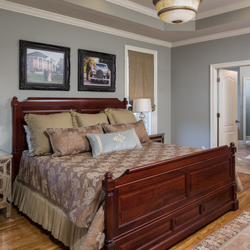 Tommy Daspit Photographer
Tommy Daspit
Tommy Daspit is an Architectural, Commercial, Real Estate, and Google Maps Business View Trusted photographer in Birmingham, Alabama. Tommy provides the best in commercial photography in the southeastern United States (Alabama, Georgia, North Carolina, South Carolina, Florida, Mississippi, Louisiana, and Tennessee).View more of his work on his homepage: http://tommmydaspit.com/
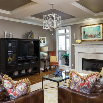 Tommy Daspit Photographer
Tommy Daspit
Tommy Daspit is an Architectural, Commercial, Real Estate, and Google Maps Business View Trusted photographer in Birmingham, Alabama. Tommy provides the best in commercial photography in the southeastern United States (Alabama, Georgia, North Carolina, South Carolina, Florida, Mississippi, Louisiana, and Tennessee).View more of his work on his homepage: http://tommmydaspit.com/

 Jessica Lagrange Interiors
State Parkway, Jessica Lagrange Interiors LLC, Photo by Tony Soluri
Example of a classic dark wood floor living room design in Chicago with a standard fireplace
Example of a classic dark wood floor living room design in Chicago with a standard fireplace
Sponsored
Sunbury, OH

J.Holderby - Renovations
Franklin County's Leading General Contractors - 2X Best of Houzz!
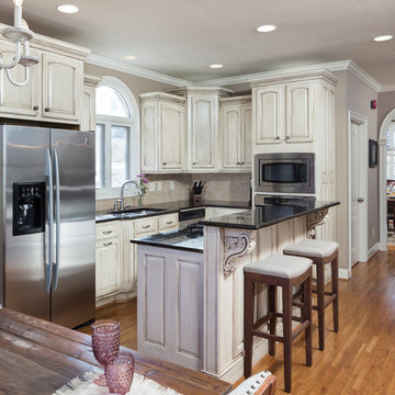 Tommy Daspit Photographer
Tommy Daspit
Tommy Daspit is an Architectural, Commercial, Real Estate, and Google Maps Business View Trusted photographer in Birmingham, Alabama. Tommy provides the best in commercial photography in the southeastern United States (Alabama, Georgia, North Carolina, South Carolina, Florida, Mississippi, Louisiana, and Tennessee).View more of his work on his homepage: http://tommmydaspit.com/
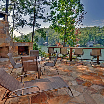
 Envision Web
Stuart Wade, Envision Virtual Tours, Inc.
Envision Virtual Tours and High Resolution Photography is your best choice to find just what you are looking for in the Lake Burton Area . Knowing the areas and resources of Lake Burton is our specialty
Lake Burton is a 2,775 acre man-made lake with 62 miles of shoreline located in the northeastern corner of Georgia in Rabun County. It is the first lake in a five-lake series called the Tallulah River Watershed that follows the original course of the Tallulah River. The series of lakes starts with Lake Burton as the northernmost lake followed by Lake Seed, Lake Rabun, Lake Tallulah Falls and the eastern arm of Lake Tugalo (the western arm is formed by the Chattooga River. The lakes are owned and operated by the Georgia Power Company to generate hydroelectric energy for Georgia's largest city, Atlanta. At one time these lakes were the largest producers of electricity in the state of Georgia. Now, they only provide peak power supply.
The lake was built in a deep valley located along a 10 mile section of the Tallulah River. The Lake Burton Dam was closed on December 22, 1919 and the lake started to fill. The dam is a gravity concrete dam, with a height of 128 feet and a span of 1,100 feet. The spillway is equipped with eight gates 22 feet wide by 6.6 feet high. The total capacity at an elevation of 1,866.6 feet is 108,000 acre-ft, of which 106,000 acre-ft is usable storage. The generating capacity of the dam is 6,120 kilowatts (two units).Lake Burton is the highest Georgia Power lake in Georgia.
Lake Burton gets its named from the town of Burton, which was the second largest town in Rabun County with a population of approximately 200 but now lies below the lake's surface. The town (and the lake) was named after local prominent citizen Jeremiah Burton and was situated along the road from Clayton, Georgia to the Nacoochee Valley. Andrew Jackson Ritchie served as the postmaster for the area for several years. Gold was first discovered in Rabun County where Dicks Creek and the Tallulah River come together and was the reason for the town's founding in the early 1800s.
The Lake Burton Fish Hatchery and Moccasin Creek State Park are located on the western side of the lake. Lake Burton is home to several species of fish, including Spotted Bass, Largemouth Bass, White Bass, Black Crappie, Bluegill, Redear Sunfish, White Catfish, Walleye, Brown Trout, Rainbow Trout, and Yellow Perch.
The residents of Lake Burton are a mix of permanent residents and seasonal vacationers who together make-up the Lake Burton Civic Association, a local organization who goal is to maintain the lake through volunteer clean-ups and other such events. Let a Lake Burton resident and expert show you the way
The Lake Burton Civic Association is an active homeowners association for residents of the Lake Burton area and sponsors many events throughout the year such as:
burton, custom, envision, georgia, lake, mountain, nc, north, photography, web, western, Lake Burton, Lake Rabun, Seed Lake,Virtual Tours.
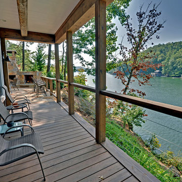 Envision Web
Stuart Wade, Envision Virtual Tours, Inc.
Envision Virtual Tours and High Resolution Photography is your best choice to find just what you are looking for in the Lake Burton Area . Knowing the areas and resources of Lake Burton is our specialty
Lake Burton is a 2,775 acre man-made lake with 62 miles of shoreline located in the northeastern corner of Georgia in Rabun County. It is the first lake in a five-lake series called the Tallulah River Watershed that follows the original course of the Tallulah River. The series of lakes starts with Lake Burton as the northernmost lake followed by Lake Seed, Lake Rabun, Lake Tallulah Falls and the eastern arm of Lake Tugalo (the western arm is formed by the Chattooga River. The lakes are owned and operated by the Georgia Power Company to generate hydroelectric energy for Georgia's largest city, Atlanta. At one time these lakes were the largest producers of electricity in the state of Georgia. Now, they only provide peak power supply.
The lake was built in a deep valley located along a 10 mile section of the Tallulah River. The Lake Burton Dam was closed on December 22, 1919 and the lake started to fill. The dam is a gravity concrete dam, with a height of 128 feet and a span of 1,100 feet. The spillway is equipped with eight gates 22 feet wide by 6.6 feet high. The total capacity at an elevation of 1,866.6 feet is 108,000 acre-ft, of which 106,000 acre-ft is usable storage. The generating capacity of the dam is 6,120 kilowatts (two units).Lake Burton is the highest Georgia Power lake in Georgia.
Lake Burton gets its named from the town of Burton, which was the second largest town in Rabun County with a population of approximately 200 but now lies below the lake's surface. The town (and the lake) was named after local prominent citizen Jeremiah Burton and was situated along the road from Clayton, Georgia to the Nacoochee Valley. Andrew Jackson Ritchie served as the postmaster for the area for several years. Gold was first discovered in Rabun County where Dicks Creek and the Tallulah River come together and was the reason for the town's founding in the early 1800s.
The Lake Burton Fish Hatchery and Moccasin Creek State Park are located on the western side of the lake. Lake Burton is home to several species of fish, including Spotted Bass, Largemouth Bass, White Bass, Black Crappie, Bluegill, Redear Sunfish, White Catfish, Walleye, Brown Trout, Rainbow Trout, and Yellow Perch.
The residents of Lake Burton are a mix of permanent residents and seasonal vacationers who together make-up the Lake Burton Civic Association, a local organization who goal is to maintain the lake through volunteer clean-ups and other such events. Let a Lake Burton resident and expert show you the way
The Lake Burton Civic Association is an active homeowners association for residents of the Lake Burton area and sponsors many events throughout the year such as:
burton, custom, envision, georgia, lake, mountain, nc, north, photography, web, western, Lake Burton, Lake Rabun, Seed Lake,Virtual Tours.
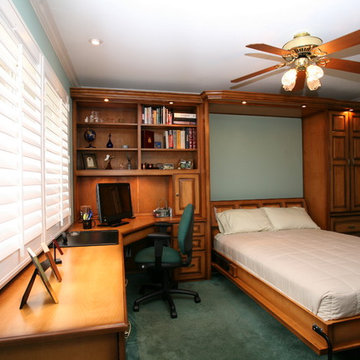
 Pacific Coast Custom Design
Stunning wallbed home office. Shown in golden 2 tone finish. Gorgeous real maple custom cabinets turned this room in to a multi-functional fantastic space.
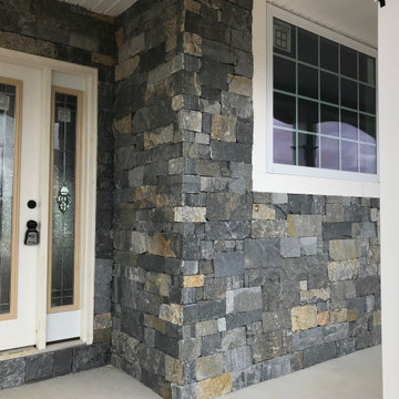
 Quarry Mill
Edmonton real thin stone veneer from the Quarry Mill adds a stately feel to the front entrance of this stunning residential home.
Example of a classic concrete floor and gray floor entryway design in Other with gray walls and a glass front door
Example of a classic concrete floor and gray floor entryway design in Other with gray walls and a glass front door
 Quarry Mill
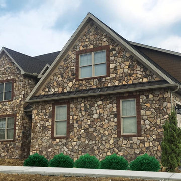
Pioneer real thin stone veneer adds a natural and traditional look to the exterior of this beautiful home. Pioneer is a natural hand-picked fieldstone that is sawed into thin stone veneer. The stone has neutral and pleasing earth tones with a soft and natural texture. Pioneer showcases the fieldstone in its completely natural state with irregular shapes. Some fieldstones are split with a hydraulic press to form ashlar, ledgestone, or castle rock style stones, whereas, Pioneer is unaltered and forms a mosaic style. Pioneer is subject to greater variation due to being a fieldstone product. This variation adds character and beauty to the unique look of Pioneer. The individual pieces give flexibility to the mason over the final appearance as the stone can be laid in a more linear fashion if desired.
Sponsored
Sunbury, OH
J.Holderby - Renovations
Franklin County's Leading General Contractors - 2X Best of Houzz!
 RealCraft
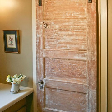
The hardware used in this project was the Hammered Flat Track Kit. It was used on an antique barn door. The owner of the home stated, "I love this door because it was my great grandfather's door. The glass knob and the coat hook are original from when I was a little girl visiting my grandfather. It is so perfect in this house. The ranch has been in my family for 6 generations. I wish you could see this almost 100 year old door with your company's hardware in person, it is a perfect craftsman match."
 Envision Web
Stuart Wade, Envision Virtual Tours
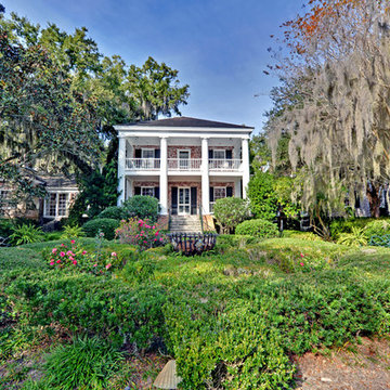
The second-largest and most developed of Georgia's barrier islands, St. Simons is approximately twelve miles long and nearly three miles wide at its widest stretch (roughly the size of Manhattan Island in New York). The island is located in Glynn County on Georgia's coast and lies east of Brunswick (the seat of Glynn County), south of Little St. Simons Island and the Hampton River, and north of Jekyll Island. The resort community of Sea Island is separated from St. Simons on the east by the Black Banks River. Known for its oak tree canopies and historic landmarks, St. Simons is both a tourist destination and, according to the 2010 U.S. census, home to 12,743 residents.
Early History
The earliest
St. Simons Island Village
record of human habitation on the island dates to the Late Archaic Period, about 5,000 to 3,000 years ago. Remnants of shell rings left behind by Native Americans from this era survive on many of the barrier islands, including St. Simons. Centuries later, during the period known by historians as the chiefdom era, the Guale Indians established a chiefdom centered on St. Catherines Island and used St. Simons as their hunting and fishing grounds. By 1500 the Guale had established a permanent village of about 200 people on St. Simons, which they called Guadalquini.
Beginning in 1568, the Spanish attempted to create missions along the Georgia coast. Catholic missions were the primary means by which Georgia's indigenous Native American chiefdoms were assimilated into the Spanish colonial system along the northern frontier of greater Spanish Florida. In the 1600s St. Simons became home to two Spanish missions: San Buenaventura de Guadalquini, on the southern tip of the island, and Santo Domingo de Asao (or Asajo), on the northern tip. Located on the inland side of the island were the pagan refugee villages of San Simón, the island's namesake, and Ocotonico. In 1684 pirate raids left the missions and villages largely abandoned.
Colonial History
As
Fort Frederica
early as 1670, with Great Britain's establishment of the colony of Carolina and its expansion into Georgia territory, Spanish rule was threatened by the English. The Georgia coast was considered "debatable land" by England and Spain, even though Spain had fully retreated from St. Simons by 1702. Thirty-one years later General James Edward Oglethorpe founded the English settlement of Savannah. In 1736 he established Fort Frederica, named after the heir to the British throne, Frederick Louis, prince of Wales, on the west side of St. Simons Island to protect Savannah and the Carolinas from the Spanish threat.
Between 1736 and 1749 Fort Frederica was the hub of British military operations along the Georgia frontier. A town of the same name grew up around the fort and was of great importance to the new colony. By 1740 Frederica's population was 1,000. In 1736 the congregation of what would become Christ Church was organized within Fort Frederica as a mission of the Church of England. Charles Wesley led the first services. In 1742 Britain's decisive victory over Spain in the Battle of Bloody Marsh, during the War of Jenkins' Ear, ended the Spanish threat to the Georgia coast. When the British regimen disbanded in 1749, most of the townspeople relocated to the mainland. Fort Frederica went into decline and, except for a short time of prosperity during the 1760s and 1770s under the leadership of merchant James Spalding, never fully recovered. Today the historic citadel's tabby ruins are maintained by the National Park Service.
Plantation Era
By the start of the American Revolution (1775-83), Fort Frederica was obsolete, and St. Simons was left largely uninhabited as most of its residents joined the patriot army. Besides hosting a small Georgia naval victory on the Fort Frederica River, providing guns from its famous fort for use at Fort Morris in Sunbury, and serving as an arena for pillaging by privateers and British soldiers, the island played almost no role in the war.
Following the war, many of the townspeople, their businesses destroyed, turned to agriculture. The island was transformed into fourteen cotton plantations after acres of live oak trees were cleared for farm land and used for building American warships, including the famous USS Constitution, or "Old Ironsides." Although rice was the predominant crop along the neighboring Altamaha River, St. Simons was known for its production of long-staple cotton, which soon came to be known as Sea Island cotton.
Between
Ebos Landing
the 1780s and the outbreak of the Civil War (1861-65), St. Simons's plantation culture flourished. The saline atmosphere and the availability of cheap slave labor proved an ideal combination for the cultivation of Sea Island cotton. In 1803 a group of Ebo slaves who survived the Middle Passage and arrived on the west side of St. Simons staged a rebellion and drowned themselves. The sacred site is known today as Ebos Landing.
One of the largest owners of land and slaves on St. Simons was Pierce Butler, master of Hampton Point Plantation, located on the northern end of the island. By 1793 Butler owned more than 500 slaves, who cultivated 800 acres of cotton on St. Simons and 300 acres of rice on Butler's Island in the Altamaha River delta. Butler's grandson, Pierce Mease Butler, who at the age of sixteen inherited a share of his grandfather's estate in 1826, was responsible for the largest sale of human beings in the history of the United States: in 1859, to restore his squandered fortune, he sold 429 slaves in Savannah for more than $300,000. The British actress and writer Fanny Kemble, whose tumultuous marriage to Pierce ended in divorce in 1849, published an eyewitness account of the evils of slavery on St. Simons in her book Journal of a Residence on a Georgian Plantation in 1838-1839 (1863).
Another
Retreat Plantation
large owner of land and slaves on St. Simons was Major William Page, a friend and employee of Pierce Butler Sr. Before purchasing Retreat Plantation on the southwestern tip of the island in 1804, Page managed the Hampton plantation and Butler's Island. Upon Page's death in 1827, Thomas Butler King inherited the land together with his wife, Page's daughter, Anna Matilda Page King. King expanded his father-in-law's planting empire on St. Simons as well as on the mainland, and by 1835 Retreat Plantation alone was home to as many as 355 slaves.
The center of life during the island's plantation era was Christ Church, Frederica. Organized in 1807 by a group of island planters, the Episcopal church is the second oldest in the Diocese of Georgia. Embargoes imposed by the War of 1812 (1812-15) prevented the parishioners from building a church structure, so they worshiped in the home of John Beck, which stood on the site of Oglethorpe's only St. Simons residence, Orange Hall.
The first Christ Church building, finished on the present site in 1820, was ruined by occupying Union troops during the Civil War. In 1884 the Reverend Anson Dodge Jr. rebuilt the church as a memorial to his first wife, Ellen. The cruciform building with a trussed gothic roof and stained-glass windows remains active today as Christ Church.
Civil War and Beyond
The
St. Simons Island Lighthouse
outbreak of the Civil War in 1861 put a sudden end to St. Simons's lucrative plantation era. In January of that year, Confederate troops were stationed at the south end of the island to guard the entrance to Brunswick Harbor. Slaves from Retreat Plantation, owned by Thomas Butler King, built earthworks and batteries. Plantation residents were scattered—the men joined the Confederate army and their families moved to the mainland. Cannon fire was heard on the island in December 1861, and Confederate troops retreated in February 1862, after dynamiting the lighthouse to keep its beacon from aiding Union troops. Soon thereafter, Union troops occupied the island, which was used as a camp for freed slaves. By August 1862 more than 500 former slaves lived on St. Simons, including Susie King Taylor, who organized a school for freed slave children. But in November the ex-slaves were taken to Hilton Head, South Carolina, and Fernandina, Florida, leaving the island abandoned.
After the Civil War the island never returned to its status as an agricultural community. The plantations lay dormant because there were no slaves to work the fields. After Union general William T. Sherman's January 1865 Special Field Order No. 15 —a demand that former plantations be divided and distributed to former slaves—was overturned by U.S. president Andrew Johnson less than a year later, freedmen and women were forced to work as sharecroppers on the small farms that dotted the land previously occupied by the sprawling plantations.
By
St. Simons Lumber Mills
1870 real economic recovery began with the reestablishment of the timber industry. Norman Dodge and Titus G. Meigs of New York set up lumber mill operations at Gascoigne Bluff, formerly Hamilton Plantation. The lumber mills provided welcome employment for both blacks and whites and also provided mail and passenger boats to the mainland. Such water traffic, together with the construction of a new lighthouse in 1872, designed by architect Charles B. Cluskey, marked the beginning of St. Simons's tourism industry. The keeper of the lighthouse created a small amusement park, which drew many visitors, as did the seemingly miraculous light that traveled from the top of the lighthouse tower to the bottom. The island became a summer retreat for families from the mainland, particularly from Baxley, Brunswick, and Waycross.
The island's resort industry was thriving by the 1880s. Beachfront structures, such as a new pier and grand hotel, were built on the southeastern end of the island and could be accessed by ferry. Around this time wealthy northerners began vacationing on the island.
Twentieth Century
The
St. Simons Island Pier and Village
opening in 1924 of the Brunswick–St. Simons Highway, today known as the Torras Causeway, was a milestone in the development of resorts in the area. St. Simons's beaches were now easily accessible to locals and tourists alike. More than 5,000 automobiles took the short drive from Brunswick to St. Simons via the causeway on its opening day, paving the way for convenient residential and resort development.
In 1926 automotive pioneer Howard Coffin of Detroit, Michigan, bought large tracts of land on St. Simons, including the former Retreat Plantation, and constructed a golf course, yacht club, paved roads, and a residential subdivision. Although the causeway had brought large numbers of summer people to the island, St. Simons remained a small community with only a few hundred permanent residents until the 1940s.
The
St. Simons Island
outbreak of World War II (1941-45) brought more visitors and residents to St. Simons. Troops stationed at Jacksonville, Florida; Savannah; and nearby Camp Stewart took weekend vacations on the island, and a new naval air base and radar school became home to even more officers and soldiers. The increased wartime population brought the island its first public school. With a major shipyard for the production of Liberty ships in nearby Brunswick, the waters of St. Simons became active with German U-boats. In April 1942, just off the coast, the Texas Company oil tanker S. S. Oklahoma and the S. S. Esso Baton Rouge were torpedoed by the Germans, bringing the war very close to home for island residents.
Due in large part to the military's improvement of the island's infrastructure during the war, development on the island boomed in the 1950s and 1960s. More permanent homes and subdivisions were built, and the island was no longer just a summer resort but also a thriving community. In 1950 the Methodist conference and retreat center Epworth by the Sea opened on Gascoigne Bluff. In 1961 novelist Eugenia Price visited St. Simons and began work on her first works of fiction, known as the St. Simons Trilogy. Inspired by real events on the island, Price's trilogy renewed interest in the history of Georgia's coast, and the novelist herself relocated to the island in 1965 and lived there for thirty-one years. St. Simons is also home to contemporary Georgia writer Tina McElroy Ansa.
Since
Epworth by the Sea
1980 St. Simons's population has doubled. The island's continued status as a vacation destination and its ongoing development boom have put historic landmarks and natural areas at risk. While such landmarks as the Fort Frederica ruins and the Battle of Bloody Marsh site are preserved and maintained by the National Park Service, and while the historic lighthouse is maintained by the Coastal Georgia Historical Society, historic Ebos Landing has been taken over by a sewage treatment plant.
Several coastal organizations have formed in recent years to save natural areas on the island. The St. Simons Land Trust, for example, has received donations of large tracts of land and plans to protect property in the island's three traditional African American neighborhoods. Despite its rapid growth and development, St. Simons remains one of the most beautiful and important islands on the Georgia coast.
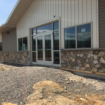 Quarry Mill
Pioneer real thin stone veneer from the Quarry Mill creates a stunning exterior wainscoting to give character to this building. Pioneer is a natural hand-picked fieldstone that is sawed into thin stone veneer. The stone has neutral and pleasing earth tones with a soft and natural texture. Pioneer showcases the fieldstone in its completely natural state with irregular shapes. Some fieldstones are split with a hydraulic press to form ashlar, ledgestone, or castle rock style stones, whereas, Pioneer is unaltered and forms a mosaic style. Pioneer is subject to greater variation due to being a fieldstone product. This variation adds character and beauty to the unique look of Pioneer. The individual pieces give flexibility to the mason over the final appearance as the stone can be laid in a more linear fashion if desired.

 Bill miller
Nobody would be foolish enough to knowingly purchase PIZZA using a third party call-center middleman.But every day, thousands of people do exactly that when they purchase flowers for delivery!
That’s because a NEW TYPE of “florist” has appeared on the scene. And that means most flower buyers pay as much as 50% MORE than they should pay!
Finding A Floral Supplier
When a prospective flower buyer wants to buy flowers, his first stop is usually the internet. The author’s flower shop is in Charlotte, NC and the two most widely used search terms in this area are: “Charlotte flowers” and “Charlotte florist.”
When the customer searches for either of these terms, he will get a list of results. Paid results (advertising) are usually shown first. Organic (website) results come after the advertisements.
When a customer clicks on an advertisement, he is usually taken to a beautiful website owned by a call-center floral middleman offering beautiful flowers, hand-delivered by a LOCAL florist. And the products are sales TAX FREE.
But what is not revealed is that the middle man does not actually have a flower shop in Charlotte!
The Difference Between Toasters and Flowers
With “durable” products like toasters and sweaters, the location of the seller isn’t terribly important. That’s because the products will be shipped from a warehousevia USPS, UPS or FedEx. But flower arrangements are *fragile* and cannot be shipped that way!
Instead, they must be locally custom-hand-crafted and hand-delivered! And this means that if a customer orders from a middleman’s website, the order must – somehow – be passed from the middleman’s company to a REAL local florist in, for example, Charlotte, NC.
This “order transfer” is done by one of the three florist-to-florist networks: FTD, Teleflora and Bloomnet (1-800-Flowers).
Too Many FEES and COMMISSIONS
Membership in these networks is not free, so the middleman always adds a “handling charge” – typically about $15 -- to the customer’s bill to help pay for hiscosts to access to the network.
Please note that the $15 handling charge usually far exceedsany TAX FREE “savings!”
But the “handling charge” only helps pay for *access* to the network. The florist-to-florist network also takes a 7% commission, and also credits a 20% selling commission back to the middleman!
What this means is that, for a typical online floral purchase, just under HALF of the customer’s money vanishes in unnecessary FEES and COMMISSIONS. By comparison, when a customer buys a toaster from an independent business listing it on Amazon, only a few percent of the purchase price goes to fees and commissions.
With this huge profit potential available to third party floral marketers, it is not surprising that these middlemen spend huge sums on advertising and sales promotion. A few years back, one even took an ad during the Super Bowl!
Buy Direct For Better Value
Clearly, the consumer will always get His Best Floral Value by placing his floral order DIRECT with a Real Florist n the City where the flowers will be delivered.
Sometimes it may be difficult to tell whether a Flower Supplier is located “in town.”Here are three easy ways to separate a “real” florist from a floral middleman:
1. Look for the street address, city and state on the website. Often this will be found on a tab labeled “About Us” or “Contact Us.” If you cannot find an address at all, then this is almost certainly a middleman!
2. Look at the telephone number. If the only number on the website is a TOLL FREE “800” number, then the floral supplier is probably not local.
3. Look at the invoice (before you click the BUY NOW button!) for any “Handling” or “Service” charges. A REAL florist will never add these charges to your bill!
For more information about Charlotte Flowers and Charlotte Florist, please visit the author’s Flower Hut website at http://flowerhut.com.
BUT, if you do not want flowers delivered to Charlotte, Matthews, Mint Hill or Pineville, NC, please do NOT order from us! Take the time to find a REAL florist in the town where you need flowers delivered. You’ll be glad you did!


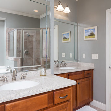 Tommy Daspit Photographer
Tommy Daspit
Tommy Daspit is an Architectural, Commercial, Real Estate, and Google Maps Business View Trusted photographer in Birmingham, Alabama. Tommy provides the best in commercial photography in the southeastern United States (Alabama, Georgia, North Carolina, South Carolina, Florida, Mississippi, Louisiana, and Tennessee).View more of his work on his homepage: http://tommmydaspit.com/


8