
Search results for "Land based wind" in Home Design Ideas
 Envision Web
Stuart Wade, Envision Virtual Tours
The second-largest and most developed of Georgia's barrier islands, St. Simons is approximately twelve miles long and nearly three miles wide at its widest stretch (roughly the size of Manhattan Island in New York). The island is located in Glynn County on Georgia's coast and lies east of Brunswick (the seat of Glynn County), south of Little St. Simons Island and the Hampton River, and north of Jekyll Island. The resort community of Sea Island is separated from St. Simons on the east by the Black Banks River. Known for its oak tree canopies and historic landmarks, St. Simons is both a tourist destination and, according to the 2010 U.S. census, home to 12,743 residents.
Early History
The earliest
St. Simons Island Village
record of human habitation on the island dates to the Late Archaic Period, about 5,000 to 3,000 years ago. Remnants of shell rings left behind by Native Americans from this era survive on many of the barrier islands, including St. Simons. Centuries later, during the period known by historians as the chiefdom era, the Guale Indians established a chiefdom centered on St. Catherines Island and used St. Simons as their hunting and fishing grounds. By 1500 the Guale had established a permanent village of about 200 people on St. Simons, which they called Guadalquini.
Beginning in 1568, the Spanish attempted to create missions along the Georgia coast. Catholic missions were the primary means by which Georgia's indigenous Native American chiefdoms were assimilated into the Spanish colonial system along the northern frontier of greater Spanish Florida. In the 1600s St. Simons became home to two Spanish missions: San Buenaventura de Guadalquini, on the southern tip of the island, and Santo Domingo de Asao (or Asajo), on the northern tip. Located on the inland side of the island were the pagan refugee villages of San Simón, the island's namesake, and Ocotonico. In 1684 pirate raids left the missions and villages largely abandoned.
Colonial History
As
Fort Frederica
early as 1670, with Great Britain's establishment of the colony of Carolina and its expansion into Georgia territory, Spanish rule was threatened by the English. The Georgia coast was considered "debatable land" by England and Spain, even though Spain had fully retreated from St. Simons by 1702. Thirty-one years later General James Edward Oglethorpe founded the English settlement of Savannah. In 1736 he established Fort Frederica, named after the heir to the British throne, Frederick Louis, prince of Wales, on the west side of St. Simons Island to protect Savannah and the Carolinas from the Spanish threat.
Between 1736 and 1749 Fort Frederica was the hub of British military operations along the Georgia frontier. A town of the same name grew up around the fort and was of great importance to the new colony. By 1740 Frederica's population was 1,000. In 1736 the congregation of what would become Christ Church was organized within Fort Frederica as a mission of the Church of England. Charles Wesley led the first services. In 1742 Britain's decisive victory over Spain in the Battle of Bloody Marsh, during the War of Jenkins' Ear, ended the Spanish threat to the Georgia coast. When the British regimen disbanded in 1749, most of the townspeople relocated to the mainland. Fort Frederica went into decline and, except for a short time of prosperity during the 1760s and 1770s under the leadership of merchant James Spalding, never fully recovered. Today the historic citadel's tabby ruins are maintained by the National Park Service.
Plantation Era
By the start of the American Revolution (1775-83), Fort Frederica was obsolete, and St. Simons was left largely uninhabited as most of its residents joined the patriot army. Besides hosting a small Georgia naval victory on the Fort Frederica River, providing guns from its famous fort for use at Fort Morris in Sunbury, and serving as an arena for pillaging by privateers and British soldiers, the island played almost no role in the war.
Following the war, many of the townspeople, their businesses destroyed, turned to agriculture. The island was transformed into fourteen cotton plantations after acres of live oak trees were cleared for farm land and used for building American warships, including the famous USS Constitution, or "Old Ironsides." Although rice was the predominant crop along the neighboring Altamaha River, St. Simons was known for its production of long-staple cotton, which soon came to be known as Sea Island cotton.
Between
Ebos Landing
the 1780s and the outbreak of the Civil War (1861-65), St. Simons's plantation culture flourished. The saline atmosphere and the availability of cheap slave labor proved an ideal combination for the cultivation of Sea Island cotton. In 1803 a group of Ebo slaves who survived the Middle Passage and arrived on the west side of St. Simons staged a rebellion and drowned themselves. The sacred site is known today as Ebos Landing.
One of the largest owners of land and slaves on St. Simons was Pierce Butler, master of Hampton Point Plantation, located on the northern end of the island. By 1793 Butler owned more than 500 slaves, who cultivated 800 acres of cotton on St. Simons and 300 acres of rice on Butler's Island in the Altamaha River delta. Butler's grandson, Pierce Mease Butler, who at the age of sixteen inherited a share of his grandfather's estate in 1826, was responsible for the largest sale of human beings in the history of the United States: in 1859, to restore his squandered fortune, he sold 429 slaves in Savannah for more than $300,000. The British actress and writer Fanny Kemble, whose tumultuous marriage to Pierce ended in divorce in 1849, published an eyewitness account of the evils of slavery on St. Simons in her book Journal of a Residence on a Georgian Plantation in 1838-1839 (1863).
Another
Retreat Plantation
large owner of land and slaves on St. Simons was Major William Page, a friend and employee of Pierce Butler Sr. Before purchasing Retreat Plantation on the southwestern tip of the island in 1804, Page managed the Hampton plantation and Butler's Island. Upon Page's death in 1827, Thomas Butler King inherited the land together with his wife, Page's daughter, Anna Matilda Page King. King expanded his father-in-law's planting empire on St. Simons as well as on the mainland, and by 1835 Retreat Plantation alone was home to as many as 355 slaves.
The center of life during the island's plantation era was Christ Church, Frederica. Organized in 1807 by a group of island planters, the Episcopal church is the second oldest in the Diocese of Georgia. Embargoes imposed by the War of 1812 (1812-15) prevented the parishioners from building a church structure, so they worshiped in the home of John Beck, which stood on the site of Oglethorpe's only St. Simons residence, Orange Hall.
The first Christ Church building, finished on the present site in 1820, was ruined by occupying Union troops during the Civil War. In 1884 the Reverend Anson Dodge Jr. rebuilt the church as a memorial to his first wife, Ellen. The cruciform building with a trussed gothic roof and stained-glass windows remains active today as Christ Church.
Civil War and Beyond
The
St. Simons Island Lighthouse
outbreak of the Civil War in 1861 put a sudden end to St. Simons's lucrative plantation era. In January of that year, Confederate troops were stationed at the south end of the island to guard the entrance to Brunswick Harbor. Slaves from Retreat Plantation, owned by Thomas Butler King, built earthworks and batteries. Plantation residents were scattered—the men joined the Confederate army and their families moved to the mainland. Cannon fire was heard on the island in December 1861, and Confederate troops retreated in February 1862, after dynamiting the lighthouse to keep its beacon from aiding Union troops. Soon thereafter, Union troops occupied the island, which was used as a camp for freed slaves. By August 1862 more than 500 former slaves lived on St. Simons, including Susie King Taylor, who organized a school for freed slave children. But in November the ex-slaves were taken to Hilton Head, South Carolina, and Fernandina, Florida, leaving the island abandoned.
After the Civil War the island never returned to its status as an agricultural community. The plantations lay dormant because there were no slaves to work the fields. After Union general William T. Sherman's January 1865 Special Field Order No. 15 —a demand that former plantations be divided and distributed to former slaves—was overturned by U.S. president Andrew Johnson less than a year later, freedmen and women were forced to work as sharecroppers on the small farms that dotted the land previously occupied by the sprawling plantations.
By
St. Simons Lumber Mills
1870 real economic recovery began with the reestablishment of the timber industry. Norman Dodge and Titus G. Meigs of New York set up lumber mill operations at Gascoigne Bluff, formerly Hamilton Plantation. The lumber mills provided welcome employment for both blacks and whites and also provided mail and passenger boats to the mainland. Such water traffic, together with the construction of a new lighthouse in 1872, designed by architect Charles B. Cluskey, marked the beginning of St. Simons's tourism industry. The keeper of the lighthouse created a small amusement park, which drew many visitors, as did the seemingly miraculous light that traveled from the top of the lighthouse tower to the bottom. The island became a summer retreat for families from the mainland, particularly from Baxley, Brunswick, and Waycross.
The island's resort industry was thriving by the 1880s. Beachfront structures, such as a new pier and grand hotel, were built on the southeastern end of the island and could be accessed by ferry. Around this time wealthy northerners began vacationing on the island.
Twentieth Century
The
St. Simons Island Pier and Village
opening in 1924 of the Brunswick–St. Simons Highway, today known as the Torras Causeway, was a milestone in the development of resorts in the area. St. Simons's beaches were now easily accessible to locals and tourists alike. More than 5,000 automobiles took the short drive from Brunswick to St. Simons via the causeway on its opening day, paving the way for convenient residential and resort development.
In 1926 automotive pioneer Howard Coffin of Detroit, Michigan, bought large tracts of land on St. Simons, including the former Retreat Plantation, and constructed a golf course, yacht club, paved roads, and a residential subdivision. Although the causeway had brought large numbers of summer people to the island, St. Simons remained a small community with only a few hundred permanent residents until the 1940s.
The
St. Simons Island
outbreak of World War II (1941-45) brought more visitors and residents to St. Simons. Troops stationed at Jacksonville, Florida; Savannah; and nearby Camp Stewart took weekend vacations on the island, and a new naval air base and radar school became home to even more officers and soldiers. The increased wartime population brought the island its first public school. With a major shipyard for the production of Liberty ships in nearby Brunswick, the waters of St. Simons became active with German U-boats. In April 1942, just off the coast, the Texas Company oil tanker S. S. Oklahoma and the S. S. Esso Baton Rouge were torpedoed by the Germans, bringing the war very close to home for island residents.
Due in large part to the military's improvement of the island's infrastructure during the war, development on the island boomed in the 1950s and 1960s. More permanent homes and subdivisions were built, and the island was no longer just a summer resort but also a thriving community. In 1950 the Methodist conference and retreat center Epworth by the Sea opened on Gascoigne Bluff. In 1961 novelist Eugenia Price visited St. Simons and began work on her first works of fiction, known as the St. Simons Trilogy. Inspired by real events on the island, Price's trilogy renewed interest in the history of Georgia's coast, and the novelist herself relocated to the island in 1965 and lived there for thirty-one years. St. Simons is also home to contemporary Georgia writer Tina McElroy Ansa.
Since
Epworth by the Sea
1980 St. Simons's population has doubled. The island's continued status as a vacation destination and its ongoing development boom have put historic landmarks and natural areas at risk. While such landmarks as the Fort Frederica ruins and the Battle of Bloody Marsh site are preserved and maintained by the National Park Service, and while the historic lighthouse is maintained by the Coastal Georgia Historical Society, historic Ebos Landing has been taken over by a sewage treatment plant.
Several coastal organizations have formed in recent years to save natural areas on the island. The St. Simons Land Trust, for example, has received donations of large tracts of land and plans to protect property in the island's three traditional African American neighborhoods. Despite its rapid growth and development, St. Simons remains one of the most beautiful and important islands on the Georgia coast.
 Envision Web
Stuart Wade, Envision Virtual Tours
The second-largest and most developed of Georgia's barrier islands, St. Simons is approximately twelve miles long and nearly three miles wide at its widest stretch (roughly the size of Manhattan Island in New York). The island is located in Glynn County on Georgia's coast and lies east of Brunswick (the seat of Glynn County), south of Little St. Simons Island and the Hampton River, and north of Jekyll Island. The resort community of Sea Island is separated from St. Simons on the east by the Black Banks River. Known for its oak tree canopies and historic landmarks, St. Simons is both a tourist destination and, according to the 2010 U.S. census, home to 12,743 residents.
Early History
The earliest
St. Simons Island Village
record of human habitation on the island dates to the Late Archaic Period, about 5,000 to 3,000 years ago. Remnants of shell rings left behind by Native Americans from this era survive on many of the barrier islands, including St. Simons. Centuries later, during the period known by historians as the chiefdom era, the Guale Indians established a chiefdom centered on St. Catherines Island and used St. Simons as their hunting and fishing grounds. By 1500 the Guale had established a permanent village of about 200 people on St. Simons, which they called Guadalquini.
Beginning in 1568, the Spanish attempted to create missions along the Georgia coast. Catholic missions were the primary means by which Georgia's indigenous Native American chiefdoms were assimilated into the Spanish colonial system along the northern frontier of greater Spanish Florida. In the 1600s St. Simons became home to two Spanish missions: San Buenaventura de Guadalquini, on the southern tip of the island, and Santo Domingo de Asao (or Asajo), on the northern tip. Located on the inland side of the island were the pagan refugee villages of San Simón, the island's namesake, and Ocotonico. In 1684 pirate raids left the missions and villages largely abandoned.
Colonial History
As
Fort Frederica
early as 1670, with Great Britain's establishment of the colony of Carolina and its expansion into Georgia territory, Spanish rule was threatened by the English. The Georgia coast was considered "debatable land" by England and Spain, even though Spain had fully retreated from St. Simons by 1702. Thirty-one years later General James Edward Oglethorpe founded the English settlement of Savannah. In 1736 he established Fort Frederica, named after the heir to the British throne, Frederick Louis, prince of Wales, on the west side of St. Simons Island to protect Savannah and the Carolinas from the Spanish threat.
Between 1736 and 1749 Fort Frederica was the hub of British military operations along the Georgia frontier. A town of the same name grew up around the fort and was of great importance to the new colony. By 1740 Frederica's population was 1,000. In 1736 the congregation of what would become Christ Church was organized within Fort Frederica as a mission of the Church of England. Charles Wesley led the first services. In 1742 Britain's decisive victory over Spain in the Battle of Bloody Marsh, during the War of Jenkins' Ear, ended the Spanish threat to the Georgia coast. When the British regimen disbanded in 1749, most of the townspeople relocated to the mainland. Fort Frederica went into decline and, except for a short time of prosperity during the 1760s and 1770s under the leadership of merchant James Spalding, never fully recovered. Today the historic citadel's tabby ruins are maintained by the National Park Service.
Plantation Era
By the start of the American Revolution (1775-83), Fort Frederica was obsolete, and St. Simons was left largely uninhabited as most of its residents joined the patriot army. Besides hosting a small Georgia naval victory on the Fort Frederica River, providing guns from its famous fort for use at Fort Morris in Sunbury, and serving as an arena for pillaging by privateers and British soldiers, the island played almost no role in the war.
Following the war, many of the townspeople, their businesses destroyed, turned to agriculture. The island was transformed into fourteen cotton plantations after acres of live oak trees were cleared for farm land and used for building American warships, including the famous USS Constitution, or "Old Ironsides." Although rice was the predominant crop along the neighboring Altamaha River, St. Simons was known for its production of long-staple cotton, which soon came to be known as Sea Island cotton.
Between
Ebos Landing
the 1780s and the outbreak of the Civil War (1861-65), St. Simons's plantation culture flourished. The saline atmosphere and the availability of cheap slave labor proved an ideal combination for the cultivation of Sea Island cotton. In 1803 a group of Ebo slaves who survived the Middle Passage and arrived on the west side of St. Simons staged a rebellion and drowned themselves. The sacred site is known today as Ebos Landing.
One of the largest owners of land and slaves on St. Simons was Pierce Butler, master of Hampton Point Plantation, located on the northern end of the island. By 1793 Butler owned more than 500 slaves, who cultivated 800 acres of cotton on St. Simons and 300 acres of rice on Butler's Island in the Altamaha River delta. Butler's grandson, Pierce Mease Butler, who at the age of sixteen inherited a share of his grandfather's estate in 1826, was responsible for the largest sale of human beings in the history of the United States: in 1859, to restore his squandered fortune, he sold 429 slaves in Savannah for more than $300,000. The British actress and writer Fanny Kemble, whose tumultuous marriage to Pierce ended in divorce in 1849, published an eyewitness account of the evils of slavery on St. Simons in her book Journal of a Residence on a Georgian Plantation in 1838-1839 (1863).
Another
Retreat Plantation
large owner of land and slaves on St. Simons was Major William Page, a friend and employee of Pierce Butler Sr. Before purchasing Retreat Plantation on the southwestern tip of the island in 1804, Page managed the Hampton plantation and Butler's Island. Upon Page's death in 1827, Thomas Butler King inherited the land together with his wife, Page's daughter, Anna Matilda Page King. King expanded his father-in-law's planting empire on St. Simons as well as on the mainland, and by 1835 Retreat Plantation alone was home to as many as 355 slaves.
The center of life during the island's plantation era was Christ Church, Frederica. Organized in 1807 by a group of island planters, the Episcopal church is the second oldest in the Diocese of Georgia. Embargoes imposed by the War of 1812 (1812-15) prevented the parishioners from building a church structure, so they worshiped in the home of John Beck, which stood on the site of Oglethorpe's only St. Simons residence, Orange Hall.
The first Christ Church building, finished on the present site in 1820, was ruined by occupying Union troops during the Civil War. In 1884 the Reverend Anson Dodge Jr. rebuilt the church as a memorial to his first wife, Ellen. The cruciform building with a trussed gothic roof and stained-glass windows remains active today as Christ Church.
Civil War and Beyond
The
St. Simons Island Lighthouse
outbreak of the Civil War in 1861 put a sudden end to St. Simons's lucrative plantation era. In January of that year, Confederate troops were stationed at the south end of the island to guard the entrance to Brunswick Harbor. Slaves from Retreat Plantation, owned by Thomas Butler King, built earthworks and batteries. Plantation residents were scattered—the men joined the Confederate army and their families moved to the mainland. Cannon fire was heard on the island in December 1861, and Confederate troops retreated in February 1862, after dynamiting the lighthouse to keep its beacon from aiding Union troops. Soon thereafter, Union troops occupied the island, which was used as a camp for freed slaves. By August 1862 more than 500 former slaves lived on St. Simons, including Susie King Taylor, who organized a school for freed slave children. But in November the ex-slaves were taken to Hilton Head, South Carolina, and Fernandina, Florida, leaving the island abandoned.
After the Civil War the island never returned to its status as an agricultural community. The plantations lay dormant because there were no slaves to work the fields. After Union general William T. Sherman's January 1865 Special Field Order No. 15 —a demand that former plantations be divided and distributed to former slaves—was overturned by U.S. president Andrew Johnson less than a year later, freedmen and women were forced to work as sharecroppers on the small farms that dotted the land previously occupied by the sprawling plantations.
By
St. Simons Lumber Mills
1870 real economic recovery began with the reestablishment of the timber industry. Norman Dodge and Titus G. Meigs of New York set up lumber mill operations at Gascoigne Bluff, formerly Hamilton Plantation. The lumber mills provided welcome employment for both blacks and whites and also provided mail and passenger boats to the mainland. Such water traffic, together with the construction of a new lighthouse in 1872, designed by architect Charles B. Cluskey, marked the beginning of St. Simons's tourism industry. The keeper of the lighthouse created a small amusement park, which drew many visitors, as did the seemingly miraculous light that traveled from the top of the lighthouse tower to the bottom. The island became a summer retreat for families from the mainland, particularly from Baxley, Brunswick, and Waycross.
The island's resort industry was thriving by the 1880s. Beachfront structures, such as a new pier and grand hotel, were built on the southeastern end of the island and could be accessed by ferry. Around this time wealthy northerners began vacationing on the island.
Twentieth Century
The
St. Simons Island Pier and Village
opening in 1924 of the Brunswick–St. Simons Highway, today known as the Torras Causeway, was a milestone in the development of resorts in the area. St. Simons's beaches were now easily accessible to locals and tourists alike. More than 5,000 automobiles took the short drive from Brunswick to St. Simons via the causeway on its opening day, paving the way for convenient residential and resort development.
In 1926 automotive pioneer Howard Coffin of Detroit, Michigan, bought large tracts of land on St. Simons, including the former Retreat Plantation, and constructed a golf course, yacht club, paved roads, and a residential subdivision. Although the causeway had brought large numbers of summer people to the island, St. Simons remained a small community with only a few hundred permanent residents until the 1940s.
The
St. Simons Island
outbreak of World War II (1941-45) brought more visitors and residents to St. Simons. Troops stationed at Jacksonville, Florida; Savannah; and nearby Camp Stewart took weekend vacations on the island, and a new naval air base and radar school became home to even more officers and soldiers. The increased wartime population brought the island its first public school. With a major shipyard for the production of Liberty ships in nearby Brunswick, the waters of St. Simons became active with German U-boats. In April 1942, just off the coast, the Texas Company oil tanker S. S. Oklahoma and the S. S. Esso Baton Rouge were torpedoed by the Germans, bringing the war very close to home for island residents.
Due in large part to the military's improvement of the island's infrastructure during the war, development on the island boomed in the 1950s and 1960s. More permanent homes and subdivisions were built, and the island was no longer just a summer resort but also a thriving community. In 1950 the Methodist conference and retreat center Epworth by the Sea opened on Gascoigne Bluff. In 1961 novelist Eugenia Price visited St. Simons and began work on her first works of fiction, known as the St. Simons Trilogy. Inspired by real events on the island, Price's trilogy renewed interest in the history of Georgia's coast, and the novelist herself relocated to the island in 1965 and lived there for thirty-one years. St. Simons is also home to contemporary Georgia writer Tina McElroy Ansa.
Since
Epworth by the Sea
1980 St. Simons's population has doubled. The island's continued status as a vacation destination and its ongoing development boom have put historic landmarks and natural areas at risk. While such landmarks as the Fort Frederica ruins and the Battle of Bloody Marsh site are preserved and maintained by the National Park Service, and while the historic lighthouse is maintained by the Coastal Georgia Historical Society, historic Ebos Landing has been taken over by a sewage treatment plant.
Several coastal organizations have formed in recent years to save natural areas on the island. The St. Simons Land Trust, for example, has received donations of large tracts of land and plans to protect property in the island's three traditional African American neighborhoods. Despite its rapid growth and development, St. Simons remains one of the most beautiful and important islands on the Georgia coast.

Find the right local pro for your project
 Betsy Bassett Interiors
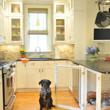
This new kitchen design was created to eliminate dog pens. An L-shaped design allowed for a dog den base cabinet to be incorporated into the kitchen layout.
Photo Credit: Betsy Bassett

 User
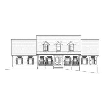
UserThis home is a custom home based on the Hampton Circle 597 Southland Homes Plan. The home is Under Construction and is Job # 4047.
The home has 2997 square feet of living area, 491 square feet of covered porch area and 2 car garage / workshop for a total of 5835 square feet under roof.
The exterior features of this home are: Fiber Cement Siding
This home is on a Full Basement has 4 bedrooms, 3 baths and the following additional rooms: Kitchen, Laundry Room, Breakfast Room, Dining Room, Family Room, Bonus Room, Foyer, Library/Study Room.
When this home was purchased, the approximate price to custom build on their land was $323,000, not including land, land improvements (e.g. grading, well, septic tank, etc) or financing. Please note that the actual cost to build may vary based on area and options chosen.
For more information, to see the floorplan for this home or to see the actual home please contact the Dawsonville Model Home Center / Office by phone at 706-216-0099 or by email at dawson@southlandcustomhomes.com.
 Alcatraz Dish Network Services
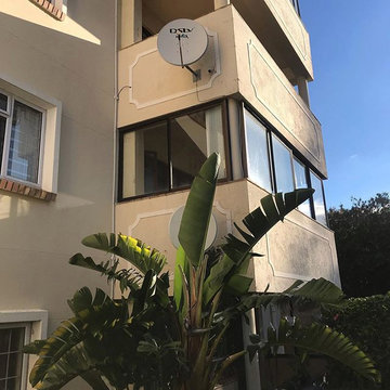
We are accredited DStv,Zuku Satellite TV,Star times,Azam,Kwese installers at an affordable Charges within Nairobi.We maintain Quality Services to Our Esteemed Customers.
What We Do
Sale and Installation of DStv, Zuku satellite,Startimes,Azam,Kwese among others.
Repair and maintenance of decoders and satellite dish.
DStv Xtraview connection.
Lost signal,Relocation,Remounting and connection of your satellite TV like: DStv,Zuku and others.
TV wall mounting.
Central/Communal dish and aerial sharing for apartments.
Hotel,pubs and clubs connection.
Installation of Free to Air satellite TV ie Christian channel Nilesat,Arabsat,Eshail,Indian Channels and many more.
Satellite Decoders and Dishes,Aerials,Cables,Lnbs,Multi switches, remotes,adapters,and other accessories.
Our services are available in;
14 Riverside, 1st Parklands Avenue, 2nd Parklands Avenue, 3rd Parklands Avenue, 7th Drive Kiambu Road, AA, Accra Road Nairobi CBD, Achego, Adams Arcade, Afraha, Aga Khan, Aga Khan Parkside Tower, Ahero Irrig Sche., Ainamoi, Air Base, Air Base Embakasi, Akiba, Akiba South C, Allsops, Alwala, Amalo, Anding'O Opanga, Anmer, Area 4a Mathare, Athi River, Athi RiverMlolongo, Avenue Park, Avenue Park Kenyatta Avenue, Avenue Park Moi Avenue, Baba Dogo, Bahati, Bahazi road, BaloziSouth B, Bamburi, Baraka, Baraka Embakasi, Baringo, Base Zimmerman, Bathi, Bella View, BellaView, Biashara, Birikani, Bofu, Bogani Karen, Bomas Lang'ata, Bombolulu, Bomet, Bondeni, Bungoma, Bunyala Road Upper Hill, Buruburu, Busia, Cabanas, Caleb Centre, Caleb Centre Kahawa Wendani, California, Cannopy Zimmerman, Capital Centre, Carnivore Lang'ata, CBD Mombasa, Chaani, Changamwe, Chiromo, Chyulu Road Upper Hill, Cianda, CID Kiambu Road, Cinemax Nyali, City Cabanas, City Centre Nairobi CBD, City Square Nairobi CBD, Clay Works Kasarani, Clean shelf Kahawa West, Coast, Dagoretti, Dagoretti Kirigu, Dagoretti Maziwa, Dagoretti Mutuini, Dagoretti Ngando, Dagoretti Ruthimitu, Dandora, Dandora Maili Saba, Dennis Pritt Road Kileleshwa, Dennis Pritt Road Kilimani, Diani, Diani Beach, Diani Diani Beach, Don Bosco Upper Hill, Donholm, Donholm Greenfields Estate, Donholm Greenspan, Donholm Phase 5, DStv, Eastern, Eastleigh, Eastleigh North, Eastleigh NorthEastleigh South, Eastleigh South, Elgeyo Marakwet Road Kileleshwa, Elgon Road Upper Hill, Embakasi, Engen Kahawa Sukari, Escarpment, Everest park, Fedha, Fig Tree Ngara, Fourways Junction, Gacharage, Gachege, Gachie, Gachika, Gachoire, Gakoe, Galleria Lang'ata, Ganjoni, Garden Estate, Gasolina, Gatei, Gathage, Gathaite, Gathanga, Gathangari, Gathugu, Gatimu, Gatina, Gatithia, Gatitu, Gatuanyaga, Gatukuyu, Gatwikira Industrial Area, Giathieko, Gichagi, Gigiri, Gikambura, Gikomba, Gitanga Road Lavington, Githunguri, Githurai, Githurai 44, Githurai 45, Gitiba, Gitiha, Gituamba, Golden Gate South B, Golf Course, Golf Course Ngong Road, Golf Course Ngumo estate, Gorofani, Guarage Kahawa Sukari, Gwa Kairo, Hamza, Handege, Harambee, Hardy, Hazina South B, High Level, Highridge, Highrise, Hill Lane Upper Hill, Hospital Road Upper Hill, Humbergers Kahawa Wendani, Hunters Kasarani, Hurlingham, Huruma, ICIPE Kasarani, Imara Daima, Impala, Industrial Area, Industrial Area Gatwikira, Industrial Area Mukuru Kayaba, Island Mshomoroni, Ithanji, Jacaranda Gardens, Jacaranda Upper Hill, Jakai, Jamhuri, Jamia University Way Nairobi CBD, Jamuhuri Ngara, Jericho, JKIA, Jogoo Road, Jogoo Road Kiamunyi, Jogoo Road Maringo, Jomvu, Jomvu Kuu, Joska, Jubilee Estate Kahawa West, Juja, Juja Kahawa Sukari, Junction Kilimani, Junction Ngong Road, Junda, Kabarsiran Lavington, Kabete, Kabuku, Kagaa, Kagongo, Kagwe, Kahawa Sukari, Kahawa Sukari Engen, Kahawa Sukari Guarage, Kahawa Sukari Quickmatt, Kahawa Wendani, Kahawa Wendani Humbergers, Kahawa Wendani Magunas, Kahawa Wendani Matopeni, Kahawa Wendani Nakumatt, Kahawa Wendani Progi, Kahawa West, Kahawa West Clean shelf, Kahawa West Jacaranda Gardens, Kahawa West Jubilee Estate, Kahawa West Kamae, Kahawa West Kamiti, Kahawa West Kongo-Soweto, Kahawa West Maziwa, Kahawa West Membley, Kahawa West Njua, Kahuguini, Kairi, Kakamega, Kalimoni, Kaloleni, Kamae, Kamae Kahawa West, Kambaa, Kamburu, Kamirithu, Kamiti, Kamiti Kahawa West, Kamukabi, Kamukunji, Kamukunji Bondeni, Kamukunji Gorofani, Kamukunji Land Mawe, Kamulu, Kamuthi Kasarani, Kangemi, Kanjai, Kanunga, Karai, Karambaini, Karanjee, Karatina, Karatu, Karen, Karen Bogani, Karen Marlura Gardens, Karen Miotoni, Kari, Karimeni, Karinga, Kariobangi, Kariobangi Mowlem, Kariobangi North, Kariobangi South, Kariokor, Karunga, Karuri, Kasarani, Kasarani Clay Works, Kasarani Hunters, Kasarani ICIPE, Kasarani Kamuthi, Kasarani Mwiirigo, Kasarani Nairobi CBD, Kasarani Njathaini, Kasarani Santon, Kasarani Seasons, Kasarani Sportsview, Kasarani Stone Groove, Kasuku Center Kileleshwa, Katani, Kawaida, Kawangware, Kawangware Gatina, Kayole, Kempinski Westlands, KEMRI, KEMRI Ngumo estate, Kenya Road Upper Hill, Kenyatta, Kenyatta Avenue, Kenyatta Market, Kenyatta Market Ngumo estate, Kerarapon, Kerarapon 7th Drive, Kerwa, Kiaibabu, Kiairia, Kiamaiko, Kiambaa, Kiambere Road Upper Hill, Kiambu, Kiambu Road, Kiambu Road CID, Kiambu Road Njathaini, Kiambu Town, Kiambururu, Kiamumbi, Kiamunyi, Kiamuoria, Kiamwangi, Kiaora, Kibarage, Kibarage Lower Kabete, Kibera, Kibera Kenyatta Golf Course, Kibera Laini Saba, Kibera Lindi, Kibera Makina, Kibera Mugumoini, Kibera Olympic, Kibera Sarang'ombe, Kibera Woodley, Kibokoni, Kiembeni, Kiganjo, Kihara, Kijabe, Kikowani, Kikuyu, Kileleshwa, Kileleshwa Dennis Pritt Road, Kileleshwa Elgeyo Marakwet Road, Kileleshwa Kasuku Center, Kileleshwa Migori Road, Kileleshwa Milimani Estate, Kileleshwa Nyeri crescent, Kileleshwa Ole Dume, Kilifi, Kilimani, Kilimani Dennis Pritt Road, Kilimani Junction, Kilimani Kirichwa, Kilimani Kirichwa Road, Kilimani Prestige, Kilimani Riara Road, Kilimani Wood Avenue, Kilimani Yaya, Kilimanjaro AvenueUpper Hill, Kilindini, Kimathi, Kimathi Street Nairobi CBD, Kinale, King'Orani, Kipevu, Kirangari, Kirenga, Kirichwa, Kirichwa Road Kilimani, Kirigu, Kisauni, Kiserian, Kisumu, Kisumu Ndogo, Kitengela, Kitisuru, Kitsuru, Kiwanja, Kizingo, kiziwi, Koinange Street Nairobi CBD, Komarock, Komarocks, Kona, Kongo-Soweto Kahawa West, Kongowea, Korogocho, Kuze Kwa Shee, Kwa Shee, Kwakiziwi, Kwale, Kyuna, Laini Saba Kibera, Lake viewLang'ata, Lakeview, Land Mawe, Lang'ata Bomas, Lang'ata Carnivore, Lang'ata Galleria, Lang'ata Ngei, Lang'ata Nyayo Highrise, Lang'ata St Marys Hospital, Lang'ata Strathmore, Lang'ata Wilson Airport, Langata, Lari Scheme, Lavington, Lavington Bahazi road, Lavington Gitanga Road, Lavington Kabarsiran, Lavington Masanduku Lane, Lavington Mbaazi Avenue, Lavington Valley Arcade, Legeza, Lenana Ngong Road, Likoni, Limuru, Lindi Kibera, Links, Loresho, Lower Hill Road Upper Hill, Lower Kabete, Lower Kabete Road, Lumumba drive, Lumumba drive Roysambu, Luthuli Avenue Nairobi CBD, Mabatini Mathare, Mabrouke, Madaraka, Madaraka Nairobi West, Madina Estate South C, Magina, Magogoni, Magongo, Magunas Kahawa Wendani, Maili Saba, Majengo, Majengo Jogoo Road, Majengo King'Orani, Makadara, Makadara Hamza Makadara Jericho, Makina, Makongeni, Makongeni Jogoo Road, Makupa, MakupaMaweni, Makwa, Malindi, Mangu, Mara Road Upper Hill, Maringo, Marlura Gardens Karen, Masaba RoadUpper Hill, Masanduku Lane Lavington, Mataara, Mathare, Mathare Area 4a, Mathare Mabatini, Mathare Mlango Kubwa, Mathare North, Matopeni Kahawa Wendani, Matuguta, Maweni, Maziwa, Maziwa Kahawa West, Mbaazi Avenue Lavington, Mbagathi Way, Mbaraki, Mbari Ya Igi, Mbotela, Mbugoni, Membley Kahawa West, Mfangano Street Nairobi CBD, Mgongo, Migori Road Kileleshwa, Mihango, Mikindani, Milimani, Milimani Estate Kileleshwa, Mimosa, Mimosa Drive Runda, Mimosa Ngong Road, Miotoni, Mirema, Miritini, Mji Wa Kale, Mkindani, Mkomani, Mlango Kubwa, Mlolongo, Mnazi Moja, Moi Avenue, Moi Avenue Nairobi CBD, Mombasa, Mombasa CBD, Mombasa Island, Mowlem, Mowlem Embakasi, Mt. View Westlands, Mto Panga, Mtongwe, Mtwapa, Mtwapa Serane Estate, Muchata, Mugoya estate, Mugumoini Kibera, Mugutha, Mugutha estate, Muindi Mbingu Street Nairobi CBD, Mukuru Kayaba, Mukuru Kwa Njenga, Muthaiga, Muthangari Westlands, Muthithi Road Westlands, Muthurwa, Mvita, Mvuli Road Westlands, Mwakirunge, Mwandoni, Mwembe, Mwembe Legeza, Mwembe Tayari, Mwihoko, Mwiirigo Kasarani, Mwiki, Mwiki Kasarani, Nachu, Nairobi, Nairobi CBD, Nairobi CBD Accra Road, Nairobi CBD City Centre, Nairobi CBD City Square, Nairobi CBD Jamia University Way, Nairobi CBD Kimathi Street, Nairobi CBD Koinange Street, Nairobi CBD Luthuli Avenue, Nairobi CBD Mfangano Street, Nairobi CBD Moi Avenue, Nairobi CBD Muindi Mbingu Street, Nairobi CBD Parliament Road, Nairobi CBD River Road, Nairobi CBD Ronald Ngala, Nairobi CBD Tomboya Street, Nairobi CBD Waber Street, Nairobi Ngundu, Nairobi Panari, Nairobi South, Nairobi West, Nairobi West Hospital, Nairobi West Majengo, Nakumatt Kahawa Wendani, Nakumatt Mega, Nakumatt Ukay Westlands, Nakumatta Mega, Nakuru, Nelson Court Westlands, New Nyali, Ngara, Ngara Fig Tree, Ngara Jamuhuri, Ngara Stima Sacco, Ngara Vision Institute, Ngecha, Ngei Lang'ata, Ngoliba, Ngong, Ngong Road, Ngong Road Adams Arcade, Ngong Road Gofl Course, Ngong Road Golf Course, Ngong Road Impala, Ngong Road Junction, Ngong Road Lenana, Ngumba, Ngumo estate, Ngumo Nera, Ngumo Nera Ngundu, Ngundu, NHC Estate, Njathaini, Njathaini Kasarani, Njathaini Kiamumbi, Njiru, Njua, North Coast, NorthMathare, Nyaga, Nyali, Nyali Beach Road, Nyali Cinemax, Nyali Links Road, NyaliNyali Beach, Nyambari, Nyanduma, Nyari, Nyayo, Nyayo Estate, Nyayo Highrise Lang'ata, Nyeri crescent Kileleshwa, Obama Estate, Oldeani Crescent Upper Hill, Ole Dume Kilimani, Olympic Kibera, Ongata Rongai, Oshwal Westlands, Other, Panari, Pangani, Parklands, Parklands 1st Parklands Avenue, Parklands 2nd Parklands Avenue, Parklands 3rd Parklands Avenue, Parkside Tower, Parliament Road Nairobi CBD, Peponi, Phase 5 Eastleigh, Pioneer, Pipeline, Port Reitz, Power, Prestige Kilimani, Progi Kahawa West, Pumwani, Quickmatt Kahawa Wendani, Ragati RoadUpper Hill, Railways ClubUpper Hill, Raphta road, Redhill, Redhill Nyari, Riabai, Riara Road Kilimani, Ridge View Estate, Ridgeways, Riruta, River Road Nairobi CBD, Riverside, Riverside Estate South C, Riverside[19, Road, Ronald Ngala Nairobi CBD, Rose Gardens, Rosslyn, Roysambu, Ruai, Ruaka, Ruaraka, Ruiru, Runda, Runda Evergreen, Runda Evergreen Runda, Runda Groove, Runda Groove Saika, Runda Mimosa Drive, Saika Obama Estate, Sameer Business Park, Santon Kasarani, Sarang'ombe Kibera, Savannah, Seasons Kasarani, Serane Estate, Shanzu, Shauri Yako, Shelly Beach, Shimanzi, Sidai Estate, Sidai EstateSouth B, Sigona, South B, South B Balozi, South B Golden Gate, South B Hazina, South B Riverside Estate, South C, South C Akiba, South C Madina Estate, South C Mugoya estate, South Coast, Sportsview Kasarani, Spring Valley, St Marys Hospital Lang'ata, Standard, Starehe, Starehe Njathaini, Stima Sacco Ngara, Stone Groove, Strathmore Lang'ata, Syokimau, T-Mall, T-Mall Nairobi West, Tena Umoja, Theta, Thigiri, Thika, Thika Town, Thindigwa, Thome, Timbwani, Ting'Ang'A, Tomboya Street Nairobi CBD, Tononoka, TononokaTudor, TRM, TRM Roysambu, Tudor, Tudor Four, Uchumi Hyper, Uchumi Hyper Ngumo estate, Uhuru, Umoja, Umoja Inner Core, Umoja Inner Core Umoja, Umoja One, Umoja Tena, Umoja Three, Umoja Two, Upper Hill, Upper Hill Bunyal Road, Upper Hill Chyulu Road, Upper Hill Elgon Road, Upper Hill Hill Lane, Upper Hill Hospital Road, Upper Hill Jacaranda, Upper Hill Kenya Road, Upper Hill Kiambere Road, Upper Hill Kilimanjaro Avenue, Upper Hill Lower Hill Road, Upper Hill Mara Road, Upper Hill Masaba Road, Upper Hill Oldeani Cres, Upper Hill Ragati Road, Upper Hill Railways Club, Upper Hill Road, Upper Hill Upper Hill Road, USIU, Utange, Utawala, Utawala Mihango, Uthiru, Valley Arcade Loresho, Vescon, Vihiga, Vijiweni, Vision Institute, Viwandani, Vyemani, Waber Street Nairobi South, Waithaka, Wangunyu, Westgate, Westlands, Westlands Kempinski, Westlands Mt. View, Westlands Muthangari, Westlands Muthithi Road, Westlands Mvuli Road, Westlands Nakumatt Ukay, Westlands Nelson Court, Westlands Oshwal, Westlands Raphta road, Westlands Sarit Centre, Westlands School Lane, Westlands ,Westgate, Wilson Airport, Wood Avenue Kilimani, Woodley, Kwale

 MaryEllen Kowalewski Architect
Jaime Sanders - D76 Studios
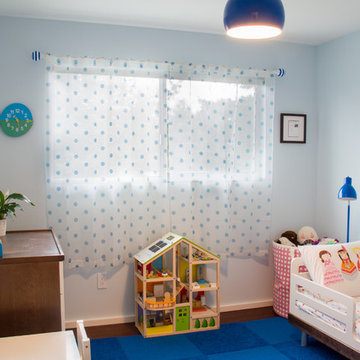
Inspiration for a small modern girl dark wood floor kids' room remodel in Portland with blue walls
Inspiration for a small modern girl dark wood floor kids' room remodel in Portland with blue walls
 Isla Homes
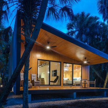
I built this on my property for my aging father who has some health issues. Handicap accessibility was a factor in design. His dream has always been to try retire to a cabin in the woods. This is what he got.
It is a 1 bedroom, 1 bath with a great room. It is 600 sqft of AC space. The footprint is 40' x 26' overall.
The site was the former home of our pig pen. I only had to take 1 tree to make this work and I planted 3 in its place. The axis is set from root ball to root ball. The rear center is aligned with mean sunset and is visible across a wetland.
The goal was to make the home feel like it was floating in the palms. The geometry had to simple and I didn't want it feeling heavy on the land so I cantilevered the structure beyond exposed foundation walls. My barn is nearby and it features old 1950's "S" corrugated metal panel walls. I used the same panel profile for my siding. I ran it vertical to math the barn, but also to balance the length of the structure and stretch the high point into the canopy, visually. The wood is all Southern Yellow Pine. This material came from clearing at the Babcock Ranch Development site. I ran it through the structure, end to end and horizontally, to create a seamless feel and to stretch the space. It worked. It feels MUCH bigger than it is.
I milled the material to specific sizes in specific areas to create precise alignments. Floor starters align with base. Wall tops adjoin ceiling starters to create the illusion of a seamless board. All light fixtures, HVAC supports, cabinets, switches, outlets, are set specifically to wood joints. The front and rear porch wood has three different milling profiles so the hypotenuse on the ceilings, align with the walls, and yield an aligned deck board below. Yes, I over did it. It is spectacular in its detailing. That's the benefit of small spaces.
Concrete counters and IKEA cabinets round out the conversation.
For those who could not live in a tiny house, I offer the Tiny-ish House.
Photos by Ryan Gamma
Staging by iStage Homes
Design assistance by Jimmy Thornton
 Housing First Minnesota
Artisan Home Tour, June 7-15th, 2014
Home #9 by Traditions by Donnay Homes
Jim Kruger, LandMark Photography
http://www.ArtisanHomeTour.org
 Deck Remodelers.com
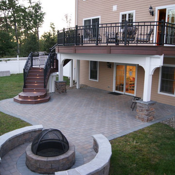
This project required a unique design to fit within the building envelope of this property while maximizing living space on and under this unusually high deck. This curved deck answered the challenge while creating a one of a kind space, connecting the second story indoor area to relaxed seating convenient to the kitchen and the lower living area to a completely protected space under the deck. The rounded design and detailed trim work add character to every perspective. Illuminated for evening entertainment the party continues after dark. A grand staircase descends to the paver patio area below. The landing at the base of the staircase adds scale while smoothing flow whether heading to the swings or to the patio. At the far end of the patio a fire feature flanked by two arched benches provides for a reflective moment or relaxed conversation amid the warm ambiance of the fire. Substructure is ACQ pine with all Zmax hardware on 12” & 16” X 42’’ deep footings. Average live load exceeds 80# per sq ft. Framing lumber is blacked out for better aesthetics.
 Lands End Development - Designers & Builders
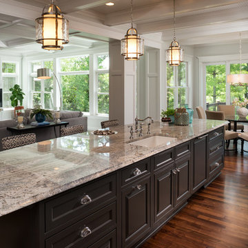
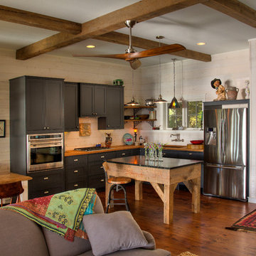
Example of a mountain style l-shaped medium tone wood floor and orange floor open concept kitchen design in Minneapolis with an undermount sink, shaker cabinets, gray cabinets, wood countertops, stainless steel appliances and an island
 Lawrence Park Development
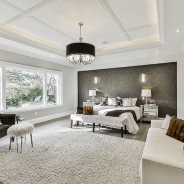
Toronto's Premier Luxury Custom Home Builders We are a Toronto based, developer, builder and custom home specialist serving Toronto & Greater Toronto Area clients., toronto luxury home builders, toronto luxury homes, toronto custom homes, luxury custom homes, luxury design, luxury homes, huge homes, design, luxury amenities, elevator, luxury staircase, As a Tarion registered builder we stick to the highest of the standards in all of our developments making it a home for life for our clients. Our philosophy is to craft homes that welcome those who enter, designed for people & not for our egos. Our aim is to design & build the buildings of the future. Services Provided
Accessory Dwelling Units (ADUs), Custom Home, Demolition, Energy-Efficient Homes, Floor Plans, Foundation Construction, Green Building, Guesthouse Design & Construction, Historic Building Conservation, Home Additions, Home Extensions, Home Remodeling, Home Restoration, House Framing, House Plans, Land Surveying, Multigenerational Homes, New Home Construction, Pool House Design & Construction, Project Management, Roof Waterproofing, Site Planning, Site Preparation, Structural Engineering, Sustainable Design, Universal Design, Waterproofing

 European Cabinets & Design Studios
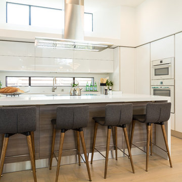
We're very proud of this beautiful modern kitchen in a new home in Menlo Park. White glossy cabinets from the Aran Cucine Erika collection and base cabinets in Jeres Elm Tranche from the Mia collection with aluminum c-channel handles. The white glossy base cabinets for the bar are also Erika, and the black round bar cabinets are from the Volare collection in high gloss lacquer.
The quartz countertop with waterfall edge is Silestone in White Zeus. Undermount sink by Blanco and range hood from Futuro Futuro. Other appliances from Miele.
Photo: Jenn Virskus / http://jenn.virskus.com/
 VISTA TILES
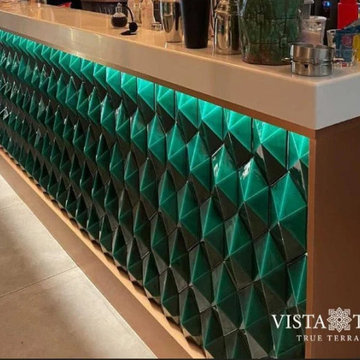
Made by VISTATILES
Ships from a small business in Pennsylvania
. It is our new diamond shaped handmade ceramic tile product suitable for wall and bar front coverings.
. Its standard dimensions are 12.5 cm x 25 cm.
. We can produce in desired colors and all metallic colors by titanium coating.
. It is a luminous model that can be easily mounted on bar, counter and wall coverings.
. It is a handmade ceramic product. It is produced with wet ceramic clay and fired at 1300 degrees. Therefore, it is suitable for indoor and
outdoor use.
. The product, which is made of terra cotta natural clay, is frequently used in indoor, outdoor, floor. The product can be produced in any
color.
. Dimension: 25 cm x 12,5 cm x 2,5 cm
. 1 m2: ~ 42 pieces - 1 m2: ~ 20 kg
. It is normal for the products to have tints in colors since they are produced by handwork.
. The color element with the decorative art of tile glazed tiles is a dimension that joins the architectural expression in multicolor.
. Ceramic-based tiles are resistant to water and chemical cleaning materials, as their water absorption is close to zero.
. Ceramic-based tile glazed tile preserves its appearance for many years. There is no loss of color and pattern.
. Water and moisture proof thanks to its glossy glazed polished surface.
. For this reason, it does not hold water on its surface, prevents the formation of bacteria and mold.
. It keeps it cool in summer and warm in winter and breathes in places where ceramic-based tile glazed tiles are used.
. Provides homogeneous distribution of sound waves thanks to its reflective feature on the glaze layer on the ceramic-based glazed tile surface
. Kütahya Seramik-based tile glazed tile is resistant to external factors such as sun, wind, etc.
. Ceramic-based tile glazed tile It is easy to use and apply.
. Kütahya patterned ceramic-based glazed tiles are used between countertops in kitchens.
. Ceramic-based shaped ceramic-based glazed tiles are suitable for use as wall tiles in bathrooms.
. Pool porcelain tiles are used in the interior flooring of the pools. Production is made in the desired color and pattern.
. For floor coverings, production is made using matte glaze by printing on the floor tiles.
. It can be used in Turkish bath, basin back panel decoration and bath decoration in wet places.
.
Please note that international buyers are responsible for any duties/customs charges and import taxes associated with shipping to their respective countries. These fees are calculated and imposed by your country when the item arrives in the country.
PLEASE NOTE THAT , in case of return there would be 25% Re stocking fee would apply to the order amount and Returning shipping cost would be pay by the customer .
 HAC Arquitectura
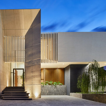
A145 features a specific program for a family whose main requirement was the versatility of the social space, having spaces wholly open and integrated and simultaneously being able to divide them for the comfort of each one of its members. The home is located in the Ayamonte Golf Club and its dividing line with the spring forest in Zapopan, with an East-West orientation, on a land of 1000m2. From an aesthetic point of view, the house was designed based on the spring forest’s primary setting. Special care was taken in the landscape design, integrating species of the region organically. Using natural materials in facades and interiors was a deliberate choice, with the intention that the construction, over the years, would become part of the natural setting and transform along with it. The residence is not just a home but a friend to the environment. It is equipped with solar panels for the house’s daily use and the pool’s heating, reducing its carbon footprint. Additionally, it has a water treatment plant, ensuring responsible water usage and management. The interior design style vividly reflects the residents’ personalities. Most of the pieces made in Mexico were designed and manufactured in a contemporary style.
 Klopf Architecture
Built for the Bluff, A Sea Ranch Home is Remade from the Inside Out
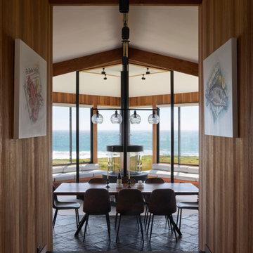
The house had always been grounded, on an ocean bluff at The Sea Ranch. It sits unencumbered, adjacent to one of the most dramatic stretches of the Sonoma coast with protected commons meadow to the east, uninterrupted Pacific views to the west, and a bluff trail running alongside. What it lacked was the feeling of home, one that could hold up its own against the natural landscape.
The owners are entrepreneurs with deep involvement across tech, real estate, and development and they know how things are built. The Sea Ranch house had been in their lives for years, a second residence and a place for family to gather. Built for a different time, it felt more compromising than comfortable. Sitting in a closed off nook, the kitchen fit one cook at a time and turned its back on the rest of the house. The entry was dim and compressed, divided by a structural column that presented itself at exactly the wrong moment. The primary suite was small relative to the view outside it. A large rear bedroom sat behind a lowered ceiling with a bathroom that had never been added. The house was certainly worth the trouble of doing it right.
What followed was not one project but four, each with its own design challenge, each addressed over a period of time.
Where the House Meets the Ocean
The most complex piece of the project, in both structural and spatial terms, was the kitchen expansion. The existing room was a single-person galley squeezed in as an afterthought with no meaningful connection to the dining room, the living space, or the deck outside. To make it useful for a family that cooks and gathers, it needed to grow outward into an existing patio and flow into the rooms around it.
A big challenge was the roofline. Several planes at different pitches and angles converged directly where additional volume was needed. A new form had to join that geometry without reading as a correction. The solution found the simplest possible connection between the existing angles, a roofline that from outside the structure, appears entirely original. From the bluff trail where the addition is visible, there is no discernible seam.
Inside, the kitchen is now open to the living and dining rooms without interruption. A large sliding glass door connects the space onto the rear deck. The deck itself was expanded and oriented so that the body of the house shields it from the coastal wind which is a common consideration that determines whether outdoor space at The Sea Ranch actually gets used. The result is a room that works for large family gatherings where no one feels cutoff, and one that makes the boundary between being inside and outside easy to ignore.
Welcoming Light
A structural column stood at the convergence of eight distinct roof planes in the entry. It was load-bearing, but it was also the reason the entry had always felt like a hallway rather than a welcoming arrival.
With the structural engineer, a custom steel connector was designed to receive beams from six separate directions, redistributing the load through a single new continuous beam. The column was surgically removed. Three triangular skylights were then cut into the roof above, their shapes drawn from the
existing geometry of the planes around them. The entry is now bright and open. The skylights feel native to the structure because they follow the logic already present in the roof.
Two Suites, Two Views
At opposite ends of the house, the two bedroom suites were each reconfigured, and each found a different way to introduce more of the landscape into the room.
An addition to the primary suite extended the structure outward to create a wraparound plan with a loop from the bedroom through bath and closet that had not been possible before. The expansion opened a slot view from the tub and shower toward the ocean. The view is precise and private. The ocean view is present and deliberate.
The rear bedroom absorbed an adjacent storage room to transform it into a full second suite with a vaulted ceiling, a large bathroom with a tub, a shower, and a sauna. A private fenced garden courtyard sits just beyond the glass bringing the outdoors inside. The tub was placed so that, looking past the courtyard and through the bedroom beyond, the ocean is visible at the far end. It is a long view and it makes the room feel larger and more settled than its footprint would suggest.
Glass on Four Sides, Fire at the Center
The main living and gathering room had always been caught between two competing facts: glass on four sides meant exceptional views but at The Sea Ranch, it also meant a cold room. A 360-degree cylindrical fireplace was added at the center on a raised stone base, providing radiant heat in every direction and giving the room a focal point around which a group naturally orients itself, whether that means two people at the end of the day or the whole family after dinner.
Owners Who Picked Up the Tools
The owner was not a passive client. they came with construction knowledge, specific ideas, and the desire to be an active part of the process, a dynamic that other architects may had found difficult, which Klopf Architecture accepted as an asset. They took it upon themselves to complete some of the work during construction, including the installation of a new radiant heating system beneath the floors.
The radiant system added to the older and less-desirable forced-air setup. At The Sea Ranch, that change matters as the house sits close enough to the ocean and moving air competes with the sound of it, where radiant heat does not. Solar panels were added to the roof as part of the new system. Insulation was upgraded throughout the walls, roof, and crawl space. The house that had always had the right setting now holds warmth the way a house on the bluff should.
They were also deeply involved in the design and selections throughout, and the finished house reflects both of them in ways that are specific rather than generic. The process took longer and moved through more iterations than a more arms-length relationship might have allowed. The result is more defined and personal because of it.
The Landscape Holds Priority
Every exterior decision was shaped by The Sea Ranch Design Standards, which require that buildings defer to the landscape around them rather than compete with it. Because this house sits on the bluff and is visible from the public trail, the additions faced a close review. Existing materials were matched. Geometries were resolved. The additions had to become indistinguishable from the original building.
From the trail, the house reads exactly as it always has — low, cedar-clad, secondary to the meadow and the water. The setting holds priority. Inside, the house has been remade.
Klopf Architecture Project Team: Geoff Campen and Trenton Jewett
Contractor: Shawn Bettega Construction
Photography: ©2025 Mariko Reed
Year Completed: 2023
Location: The Sea Ranch, CA
 Lundin Architects LLC
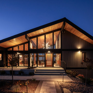
Perched on a ridge at the edge of a wooded expanse, this mid-century modern home was designed to embrace both the intimate connection to the forest and the expansive valley views beyond. The site—carefully chosen from the family’s 52-acre homestead in western Wisconsin—balances privacy and openness, placing the home at the meeting point of dense trees and rolling fields.
The approach winds through the forest, offering only glimpses of the structure. Upon arrival, the parking area is subtly positioned below the main level, reinforcing the sense of discovery. As one ascends the entry walk, the house unfolds, revealing a dramatic view through the two-story living space, anchored by a brick fireplace that extends from floor to ceiling. The asymmetrical roofline lifts upward, accentuating the openness and maximizing natural light.
Inside, warm materials define the interiors. Wood ceilings and floors, complemented by concrete-look tile, establish a natural, grounded aesthetic. Black wood-clad beams provide scale and structure, subtly delineating spaces within the open-plan layout. A wood lattice screen partially conceals the dining area from the foyer, offering both openness and privacy. The kitchen—designed for gathering—features a large island, a dedicated baking station, and a breakfast counter that catches morning light while serving as a pass-through to the adjacent patio. Two textured glass sliding panels allow the kitchen to be closed off when needed. Just beyond, a hidden gem: the home’s personal Tiki room, complete with a vintage mug collection and a full bar.
To the east, the central fireplace marks the transition to more intimate spaces. A wide stair, integrated with the hearth, leads to the lower level, while a library with a corner window creates a quiet retreat, perfect for reading and taking in the valley beyond. The primary suite extends off this wing, featuring a spa-like bath with a textured tile walk-in shower, a soaking tub positioned for dramatic views, and a private balcony overlooking the landscape.
The lower level is designed for family gatherings and extended stays. A secondary fireplace, echoing the materials of the main level, anchors a cozy living area with an adjacent kitchenette. Additional bedrooms and baths provide ample accommodations, while a hidden playhouse under the stair and a dedicated bunk room add playful touches for visiting grandchildren.
The home is a balance of openness and enclosure, modernity and warmth—designed not only as a retreat but as a multigenerational gathering place, deeply connected to the land.
 ornamental land design
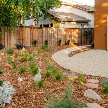
This view looks toward the back of the house, featuring a gravel patio constructed over a base of hidden hexpavers. These structural pavers lock into place beneath the gravel to prevent shifting and sinking, creating a stable surface that’s comfortable to walk on while maintaining a natural, seamless look. The curved metal arbor frames the start of a path that guides you into the yard. Early blooms are appearing in the meadow, and side plantings—chosen to mature into a soft privacy screen—are beginning to take root. Small boulders are thoughtfully placed throughout the space, adding visual interest and grounding the planting design.
 HAC Arquitectura
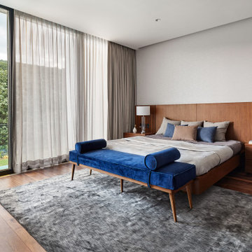
A145 features a specific program for a family whose main requirement was the versatility of the social space, having spaces wholly open and integrated and simultaneously being able to divide them for the comfort of each one of its members. The home is located in the Ayamonte Golf Club and its dividing line with the spring forest in Zapopan, with an East-West orientation, on a land of 1000m2. From an aesthetic point of view, the house was designed based on the spring forest’s primary setting. Special care was taken in the landscape design, integrating species of the region organically. Using natural materials in facades and interiors was a deliberate choice, with the intention that the construction, over the years, would become part of the natural setting and transform along with it. The residence is not just a home but a friend to the environment. It is equipped with solar panels for the house’s daily use and the pool’s heating, reducing its carbon footprint. Additionally, it has a water treatment plant, ensuring responsible water usage and management. The interior design style vividly reflects the residents’ personalities. Most of the pieces made in Mexico were designed and manufactured in a contemporary style.
13