Software
Houzz Logo Print
rewindtech

Corn seeds during a frost?

We are expecting a 32 degree frost tonight, can I plant my corn seeds today and expect them to survive that for just around an hour or two? Or do I wait till tomorrow when there is no more frost forecasted?

Comments (15)

  • 2 years ago
    last modified: 2 years ago

    Seeds would be fine because they should be planted about 1.5" deep. The question is what is the current soil temperature 2-4" down?

  • 2 years ago

    When planting seeds, it is the soil temperature that is critical, not the air temperature. No germination will occur unless soil temps are at least 50F and higher is better.

  • 2 years ago

    We are going to get lots of warm weather after this frost. Up into the 80s next week

  • 2 years ago

    But if the soil is colder than 50F, the seeds will just be dormant until it warms up. Though they may be threatened by diseases, insects, and animals. As noted, if the soil is not frozen at depth, they'll be fine. I believe that freezing corn seeds does result in some loss in germination vigor, especially if they are not completely dry.

  • 2 years ago

    There is a very remote correlation between air temperatures and soil temps. Yes, the air temps drive soil temps but there is a significant time lag between the two. Soils are much slower to warm up in spring and slower to cool down in fall. Other factors are involved as well (soil moisture, for example) but it could take a week or more of 80F daytime temps and at least 50F nighttime temps for your soils to heat up to a suitable planting temp.

  • 2 years ago
    last modified: 2 years ago

    FWIW, if you don't happen to have a soil thermometer, Syngenta has a nice 10cm soil temperature site. I think they just average over the air temperature for many days and come up with a resulting soil temperature. See here https://www.greencastonline.com/tools/soil-temperature. When I measure my soil temperature this agrees pretty well. The soil temperature is just the air temperature averaged over a couple of days. So the correlation between the two is very strong, and even precise, looking at averages. Soil moisture is a minor temperature driver in that evaporation tends to cool the soil. Soil is an OK insulator. R-value of an inch of barely moist soil is about 0,5. One inch of good home insulation is what you'd get with a foot of soil.

  • 2 years ago
    last modified: 2 years ago

    I would go ahead and plant corn if your temps are warming up from that point on. As long as your soil temps are at least 50 degrees. Field corn can be planted a little earlier ( and slightly cooler) than sweet corn.


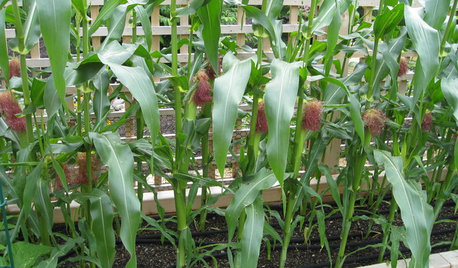
    This is my sweet corn coming up , Zone 7b. Soil temp around 52 degrees , just after the last frost.

    And corn can take a "light frost" after they're up if not more than an inch or two tall.

    Okie HU

  • 2 years ago

    Not sure where you are in Ohio, but I looked online, and your soil temps have been above 50F for about a month. Considering that germination won't happen for a few weeks, by then your soil temps will be in the 60sF. As noted, during that time, the air temperature is irrelevant.

  • PRO
    2 years ago

    I've seen the Syngenta soil map before. I have wondered where they get their numbers from. As in, where their data stations are. I can tell that they aren't where their map markers are.

  • 2 years ago
    last modified: 2 years ago

    Pretty simple. Soil is just an insulator. You take the air temperatures and average it over some number of days, and you get the soil temperature. You get air temperature from many many stations. Just basic thermal physics. If they're smart they'd figure in the soil moisture as well in the soil temperature estimates, which they can get from rainfall records. But that's a minor deal. Moisture evaporation cools the soil slightly, and moisture increases the thermal conductivity, speeding up the heat transfer a bit. In fact, I believe they do that figuring, because one of their map options is soil moisture. So they know that!

    Map markers? I don't see any map markers. You enter in your city, and it gives you the soil temperature and the soil temperature history for that city. There is one map marker, and that's it. You can get color-coded maps of soil temp and moisture, however.

    Now, I should admit that, down here, we never worry about soil temperature. It NEVER gets below 50F.

  • PRO
    2 years ago

    There is a soil moisture map provided as well. And a couple nice temps readings and pest maps. But if they are just doing math based off air temps, that would explain why their map markers are in places like in a church, a RR crossing, or a veterans memorial, heh. They are just choosing a spot in town to mark, not a station location. They aren't actually taking soil temps then, just putting up the averages based off the air math. Don't get me wrong, it's right handy to have those averages available, it can give a gardener a good general idea of what is going on down there. But it's also good to know they aren't actually tracking soil temps by taking soil temps.

    An alternative is using NOAA. I tend to like using them becuase they are doing soil probes to take the temps, and are up to date. Their map markers are where their data stations are. A downside is that they don't have stations everywhere, so I have to choose a site a few miles away if I want to use that map. I'm also fortunate in that I live within the mapping zone. I don't get sunset, but this is kind of nice instead. https://noaa.maps.arcgis.com/apps/dashboards/41e2ec1d6f184d78ac59506819c2a017

    Mapping does go out further. This is an overall one, I haven't checked into regions I'm out of though. https://www.ncei.noaa.gov/access/crn/

  • 2 years ago
    last modified: 2 years ago

    Are we looking at the same site? I don't see ANY map markers in the Syngenta site I called out. And yes, thermal physics being what it is, estimating soil temperatures by looking at air history temperatures is highly credible. The math works. Same math that is used to do forecasting. Both air and soil are being heated at the same time. As I said, it works for me. Given that air temps aren't going to be very different on the scale of a city or town, it really doesn't matter much where they get their air temperatures. The soil temp is going to be the same at the church and the RR crossing down the road. It has to be considered that the soil temperature also will depend on how much shade the site gets. I assume these models assume no shade.

    You mean https://www.weather.gov/ncrfc/LMI_SoilTemperatureDepthMaps? Yes, this is nice, if you happen to live in the upper midwest.

    I should note that https://soiltemperature.app/ also does the job,. It doesn't give much history, but it does do a forecast. Not completely clear that this is an independent model, but it gives the same numbers. There are others, and the ag community uses them routinely.

  • PRO
    2 years ago

    A map marker is something that marks something on a map. On the Sygnenta map, it's a small green marker with a pop box that gives the town name and soil info. If you put in a different town, that towns map marker pops up.

    I checked a few places, in a couple states, and I know the soil temp under a church, under a large stone memorial, and in the middle of the road of a RR crossing is not going to be the same as actual soil temps for growing. I know the map marker isn't where a data collection point is. As I said before, it's a right handy map for averages so a gardener has a good guess available. Sometimes a good guess is all we need. But it is also good to know the map is air math, not actual soil temps taken. Sometimes some gardeners want more precise information in their garden.

  • 2 years ago
    last modified: 2 years ago

    Yep, but on my Syngenta map, I see ONE marker for the city entered. Not various sites in that city. The pop box on the green marker pops out a frame with the city name, and current conditions there. But this may be different in different places. I assume that's where they're getting their climate info.

    That's true that this is a handy map that serves well for guidance. But really, with regard to soil temperatures, you're not going to measure something a lot more precisely representative of growing conditions. The temperature you read is going to depend on the soil structure exactly where you plunked your probe in. If the soil is more permeable where you stick the probe in, the temperature you measure will be closer to the air temperature. If you penetrate a clod of compost when you stick the probe in, the insulation will be better and the temperature will be further from the air temperature. So I strongly suspect that you'll get different readings in different places. With regard to gardening, there is nothing important about exact soil temperatures. If your probe measures 32.1F, I wouldn't take that as a reassuring temperature for germination of summer veggies. But if people like to run outside every day and measure temperature in some hole, that's up to them.

    I have a long-arm soil thermometer that I use for my compost piles, and it's clear that I get different soil temps in different places in my growing beds, though maybe all within about 5F. When I lived in the PNW, I knew commercial growers who just used a finger test! But my finger isn't that well calibrated.

  • PRO
    2 years ago

    Yes, I did notice that only one map marker shows at a time on that map. It would be nice if more than one could be up at the same time, but it is indeed only one at a time. The marker does seem to indicate the location of a town rather than a data collection point.

Sponsored
AIS Renovations
Average rating: 4.5 out of 5 stars15 Reviews
Custom Craftsmanship & Construction Solutions in Franklin County, Ohio