

America's Housing Patterns from Above Traditional
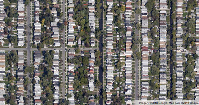
Buffalo, New York
Aerial from Google Maps.
© Google 2013
Aerial from Google Maps.
© Google 2013
What Houzz contributors are saying:

John Hill added this to Get a Bird's-Eye View of America's Housing Patterns
Suburban-urban grid. As cities grew in the late 19th and early 20th centuries, they tended to follow the grid that Thomas Jefferson laid down in the 18th century. This view of Buffalo, New York, illustrates the adherence to the grid as well as relatively small lots and houses compared to what we see today. Many areas like this were suburban but have since become incorporated into many cities. Their density (number of housing units or residents per acre) is much higher than that of subsequent suburbs. Another major difference occurs in the presence of alleys, which disappeared after the post–World War II boom; nevertheless, we'll see some recent developments later that attempt to bring back alleys for garages and services.