


Thurs. Night Tornadoes/Baseball Sized Hail along Red River
15 years ago
Sort by:Oldest
Comments (8)
Related Stories
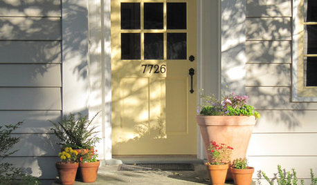
GARDENING AND LANDSCAPINGSpring Checklist: Freshen Up Your Home's Curb Appeal
Step outside and use these tips to show off your home to its best advantage this spring
Full Story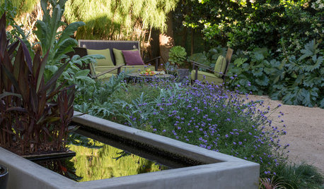
SAVING WATERHouzz Call: Are You Letting Go of Your Lawn?
Many facing a drought are swapping turf for less thirsty plantings. If you’re one of them, we’d like to hear about it
Full Story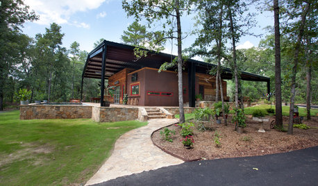
HOUZZ TOURSHouzz Tour: Under a Metal Canopy in Texas
New technology, reclaimed materials and an enormous protective roof combine in this Hawkins home for irresistible modern rustic charm
Full Story
LIFEHouzz Call: Where (and What) Are You Reading This Summer?
Whether you favor contemporary, classic or beach reads, do the long and lazy days of summer bring out the lit lover in you?
Full Story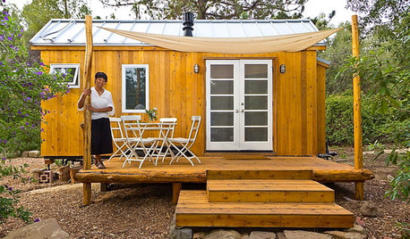
MOST POPULARHouzz Tour: Going Off the Grid in 140 Square Feet
WIth $40,000 and a vision of living more simply, a California designer builds her ‘forever’ home — a tiny house on wheels
Full Story
LIFEHow to Prepare for and Live With a Power Outage
When electricity loss puts food, water and heat in jeopardy, don't be in the dark about how to stay as safe and comfortable as possible
Full Story
Houzz Call: What Gives You the Creeps at Home?
Halloween horror got nothing on your basement, attic or closet? Show us that scary spot you steer clear of
Full Story
SMALL SPACES8 Challenges of Cottage Living
‘Small rooms or dwellings discipline the mind,’ Leonardo da Vinci once said. Just how much discipline can you handle?
Full Story
KITCHEN DESIGNHouzz Call: What’s Cooking in Your Kitchen?
Most of us turn to recipes, videos and culinary shows when we cook. Where do you set your cookbook, tablet or TV screen?
Full Story
MOST POPULARHow to Create an Inventory, Whether You're Naturally Organized or Not
Documenting your home items is essential, even if disaster seems unimaginable. And it may be easier than you think
Full Story
owiebrain
Okiedawn OK Zone 7Original Author
Related Professionals
Woburn Landscape Contractors · Fort Wayne Landscape Contractors · Hayward Landscape Contractors · Las Vegas Landscape Contractors · Mastic Beach Landscape Contractors · Pleasant Prairie Landscape Contractors · Rio Linda Landscape Contractors · Smyrna Landscape Contractors · Sun City Center Landscape Contractors · Tehachapi Landscape Contractors · Palos Hills Landscape Contractors · Reisterstown Landscape Contractors · Raytown Landscape Contractors · Bloomington Decks, Patios & Outdoor Enclosures · Cincinnati Decks, Patios & Outdoor Enclosuressoonergrandmom
spademilllane
Okiedawn OK Zone 7Original Author
soonergrandmom
Okiedawn OK Zone 7Original Author
soonergrandmom